
IMAGES TAKEN NEAR TO
St. Andrews Way, KETTERING, NN14 1NW
Introduction
This page details the photographs taken nearby to St. Andrews Way, NN14 1NW by members of the Geograph project.
The Geograph project started in 2005 with the aim of publishing, organising and preserving representative images for every square kilometre of Great Britain, Ireland and the Isle of Man.

There are currently over 7.5m images from over14,400 individuals and you can help contribute to the project by visiting https://www.geograph.org.uk
Image Map
Images are licensed for reuse under creativecommons.org/licenses/by-sa/2.0
Notes
- Clicking on the map will re-center to the selected point.
- The higher the marker number, the further away the image location is from the centre of the postcode.
Image Listing (45 Images Found)
Images are licensed for reuse under creativecommons.org/licenses/by-sa/2.0
Image
Details
Distance
1

St Andrews Close
1960s bungalows in Broughton with a footpath leading to the recreation ground.
Image: © Burgess Von Thunen
Taken: 29 Jan 2013
0.05 miles
2
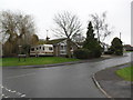
Glebe Avenue
1960s bungalows in Broughton.
Image: © Burgess Von Thunen
Taken: 29 Jan 2013
0.05 miles
3
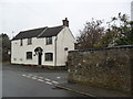
Church Street
Cottage and stone wall on the corner of St Andrews Close in Broughton.
Image: © Burgess Von Thunen
Taken: 29 Jan 2013
0.05 miles
4
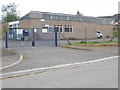
Telephone Exchange, Broughton
Situated in Church Street, this TE is of a standard design dating from the late 1960s and common throughout the United Kingdom. It has the code EMBROUG and provides telephone and broadband services to 1,807 residential and 34 non-residential premises in Broughton, plus Great Cransley, Little Cransley, Mawsley and Pytchley nearby. On the blue gates can be seen a BT warning notice and a notice that says "Please do not park in front of these gates". Also, there is a blue postbox on the gates, although it is unlikely it will receive much post apart from a bill every so often for electricity that the TE uses, which must be considerable. A BT Openreach van can just be seen at the side of this TE to the right of the photo. The numbering range of this TE is (01536) 790xxx, the (01536) referring to the Kettering group of ten TEs, and its postcode is NN14 1LU.
Image: © David Hillas
Taken: 25 Apr 2015
0.07 miles
5
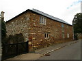
Outbuilding at Rectory Farm, Broughton
Image: © Jonathan Thacker
Taken: 28 Sep 2020
0.07 miles
6
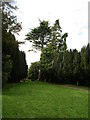
Trees in the churchyard, Broughton
Image: © Jonathan Thacker
Taken: 28 Sep 2020
0.08 miles
7
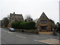
High Street
Stone property in Broughton.
Image: © Burgess Von Thunen
Taken: 29 Jan 2013
0.08 miles
9
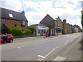
Broughton, post office & stores
On High Street.
Image: © Mike Faherty
Taken: 9 May 2014
0.09 miles
10
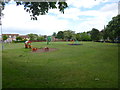
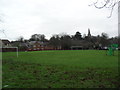
Broughton Recreation Ground
Off High Street; see also Image for the larger ground off Gate Lane.
Image: © Mike Faherty
Taken: 9 May 2014
0.09 miles