
IMAGES TAKEN NEAR TO
Church Road, KETTERING, NN14 1EL
Introduction
This page details the photographs taken nearby to Church Road, NN14 1EL by members of the Geograph project.
The Geograph project started in 2005 with the aim of publishing, organising and preserving representative images for every square kilometre of Great Britain, Ireland and the Isle of Man.

There are currently over 7.5m images from over14,400 individuals and you can help contribute to the project by visiting https://www.geograph.org.uk
Image Map
Images are licensed for reuse under creativecommons.org/licenses/by-sa/2.0
Notes
- Clicking on the map will re-center to the selected point.
- The higher the marker number, the further away the image location is from the centre of the postcode.
Image Listing (5 Images Found)
Images are licensed for reuse under creativecommons.org/licenses/by-sa/2.0
Image
Details
Distance
1
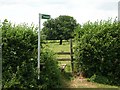
Footpath in Pytchley
The path provides a short circular walk for residents of Pytchley as well as longer walks to Walgrave and Hannington.
Image: © Will Lovell
Taken: 20 Jun 2006
0.07 miles
2
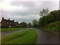
Orlingbury Road
A rainy day in Pytchley.
Image: © Burgess Von Thunen
Taken: 24 May 2013
0.10 miles
3
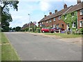
South end of Pytchley village
The 20th century housing supplements the old properties in the centre of the village.
Image: © Will Lovell
Taken: 20 Jun 2006
0.11 miles
4
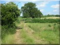
Footpath at the Bottom End of Pytchley
The footpath gives a short circular walk for village residents and longer walks to Isham and Burton Latimer
Image: © Will Lovell
Taken: 20 Jun 2006
0.16 miles
5
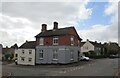
Former Post Office, Pytchley
The only remaining evidence is the post box on the right of the building.
Image: © Jonathan Thacker
Taken: 1 Oct 2020
0.24 miles