
IMAGES TAKEN NEAR TO
Halls Close, KETTERING, NN14 1AN
Introduction
This page details the photographs taken nearby to Halls Close, NN14 1AN by members of the Geograph project.
The Geograph project started in 2005 with the aim of publishing, organising and preserving representative images for every square kilometre of Great Britain, Ireland and the Isle of Man.

There are currently over 7.5m images from over14,400 individuals and you can help contribute to the project by visiting https://www.geograph.org.uk
Image Map
Images are licensed for reuse under creativecommons.org/licenses/by-sa/2.0
Notes
- Clicking on the map will re-center to the selected point.
- The higher the marker number, the further away the image location is from the centre of the postcode.
Image Listing (159 Images Found)
Images are licensed for reuse under creativecommons.org/licenses/by-sa/2.0
Image
Details
Distance
1
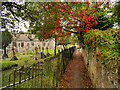
Path near Geddington Church
The path along the western side of the churchyard of Image] at Geddington.
Image: © David Dixon
Taken: 16 Sep 2017
0.04 miles
2
![Geddington houses [2]](https://s0.geograph.org.uk/geophotos/07/12/58/7125868_79aa67d5_120x120.jpg)
Geddington houses [2]
A former farmhouse, Hill Crest House, number 4 Church Hill, was built in the 17th century, or possibly earlier with alterations in the late 19th century. Constructed of coursed rubble stone and squared, coursed limestone under a Collyweston stone slate roof. Listed, grade II, with details at: https://historicengland.org.uk/listing/the-list/list-entry/1191692
Geddington is a village in Northamptonshire, on the main road between Kettering, about 3 miles southwest, and Corby, about 4 miles north. The River Ise runs through the village and is crossed by a medieval bridge. There is evidence of Iron Age, Roman and Saxon occupation. The village is home to the best preserved Eleanor cross of the three remaining. A Royal hunting lodge once stood to the north of the village but no trace remains.
Image: © Michael Dibb
Taken: 26 Sep 2021
0.05 miles
3
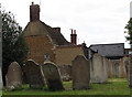
Geddington: churchyard and Church Hill
Although the rest of the row is built of the same pale limestone as most of the rest of the village, the end gable is of toast-coloured ironstone. For more about the church, see http://www.geddington.net/church/history.htm
Image: © John Sutton
Taken: 1 Jun 2011
0.05 miles
4
![Parish church [2]](https://s0.geograph.org.uk/geophotos/07/12/58/7125844_9679cdfc_120x120.jpg)
Parish church [2]
The churchyard.
The Anglican parish church of St Mary Magdalene has Anglo-Saxon origins. There are parts from the 12th, 13th and 14th centuries. The tower was heightened and there were other alterations in the 15th century. The church was restored and the porch added in the 19th century. There was another restoration in 1904-6. Constructed of coursed limestone rubble with ashlar roofs, probably of lead. Listed, grade I, with details at: https://historicengland.org.uk/listing/the-list/list-entry/1052076
Geddington is a village in Northamptonshire, on the main road between Kettering, about 3 miles southwest, and Corby, about 4 miles north. The River Ise runs through the village and is crossed by a medieval bridge. There is evidence of Iron Age, Roman and Saxon occupation. The village is home to the best preserved Eleanor cross of the three remaining. A Royal hunting lodge once stood to the north of the village but no trace remains.
Image: © Michael Dibb
Taken: 26 Sep 2021
0.05 miles
5
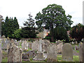
Geddington: St Mary Magdalene - churchyard
The majority of the graves are on the north side of the church. For more about the church, see http://www.geddington.net/church/history.htm
Image: © John Sutton
Taken: 1 Jun 2011
0.05 miles
6
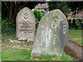
Geddington: St Mary Magdalene - churchyard
Weathered headstones. For more about the church, see http://www.geddington.net/church/history.htm
Image: © John Sutton
Taken: 1 Jun 2011
0.05 miles
7
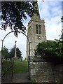
St. Mary Magdalene Geddington
The church of St. Mary Magdalene Geddington, Northamptonshire.
Image: © Keith Evans
Taken: 3 Aug 2009
0.06 miles
8
![Parish church [1]](https://s0.geograph.org.uk/geophotos/07/12/58/7125840_a3a110e6_120x120.jpg)
Parish church [1]
The Anglican parish church of St Mary Magdalene has Anglo-Saxon origins. There are parts from the 12th, 13th and 14th centuries. The tower was heightened and there were other alterations in the 15th century. The church was restored and the porch added in the 19th century. There was another restoration in 1904-6. Constructed of coursed limestone rubble with ashlar roofs, probably of lead. Listed, grade I, with details at: https://historicengland.org.uk/listing/the-list/list-entry/1052076
Geddington is a village in Northamptonshire, on the main road between Kettering, about 3 miles southwest, and Corby, about 4 miles north. The River Ise runs through the village and is crossed by a medieval bridge. There is evidence of Iron Age, Roman and Saxon occupation. The village is home to the best preserved Eleanor cross of the three remaining. A Royal hunting lodge once stood to the north of the village but no trace remains.
Image: © Michael Dibb
Taken: 26 Sep 2021
0.06 miles
9
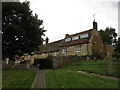
Cottages by the churchyard, Geddington
Image: © Jonathan Thacker
Taken: 2 Sep 2019
0.06 miles
10
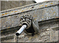
Geddington: St Mary Magdalene - gargoyle
To spout rainwater from the roof of the clerestory. For more about the church, see http://www.geddington.net/church/history.htm
Image: © John Sutton
Taken: 1 Jun 2011
0.06 miles