
IMAGES TAKEN NEAR TO
Grafton Road, KETTERING, NN14 1AJ
Introduction
This page details the photographs taken nearby to Grafton Road, NN14 1AJ by members of the Geograph project.
The Geograph project started in 2005 with the aim of publishing, organising and preserving representative images for every square kilometre of Great Britain, Ireland and the Isle of Man.

There are currently over 7.5m images from over14,400 individuals and you can help contribute to the project by visiting https://www.geograph.org.uk
Image Map
Images are licensed for reuse under creativecommons.org/licenses/by-sa/2.0
Notes
- Clicking on the map will re-center to the selected point.
- The higher the marker number, the further away the image location is from the centre of the postcode.
Image Listing (161 Images Found)
Images are licensed for reuse under creativecommons.org/licenses/by-sa/2.0
Image
Details
Distance
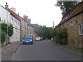
2
![Geddington houses [19]](https://s3.geograph.org.uk/geophotos/07/12/69/7126903_8d4d582f_120x120.jpg)
Geddington houses [19]
Number 17 Grafton Road is an 18th century cottage of coursed limestone rubble stone under a thatch roof. Listed, grade II, with details at: https://historicengland.org.uk/listing/the-list/list-entry/1052074
Geddington is a village in Northamptonshire, on the main road between Kettering, about 3 miles southwest, and Corby, about 4 miles north. The River Ise runs through the village and is crossed by a medieval bridge. There is evidence of Iron Age, Roman and Saxon occupation. The village is home to the best preserved Eleanor cross of the three remaining. A Royal hunting lodge once stood to the north of the village but no trace remains.
Image: © Michael Dibb
Taken: 26 Sep 2021
0.01 miles
3
![Geddington houses [20]](https://s0.geograph.org.uk/geophotos/07/12/69/7126908_97827a67_120x120.jpg)
Geddington houses [20]
Number 19 Grafton Road, nearer the camera, and number 21 Grafton Road are two 18th century cottages. Constructed of red brick on a coursed limestone rubble stone base under pantile roofs. Listed, for group value, grade II, with details at: https://historicengland.org.uk/listing/the-list/list-entry/1286934
Geddington is a village in Northamptonshire, on the main road between Kettering, about 3 miles southwest, and Corby, about 4 miles north. The River Ise runs through the village and is crossed by a medieval bridge. There is evidence of Iron Age, Roman and Saxon occupation. The village is home to the best preserved Eleanor cross of the three remaining. A Royal hunting lodge once stood to the north of the village but no trace remains.
Image: © Michael Dibb
Taken: 26 Sep 2021
0.02 miles
4
![Geddington houses [18]](https://s3.geograph.org.uk/geophotos/07/12/68/7126899_03dbcc5a_120x120.jpg)
Geddington houses [18]
A former outbuilding and two cottages have been combined to form one house, Stoneleigh, in Grafton Road. Dated 1618 with later additions and alterations. Constructed of coursed limestone rubble stone with ashlar dressings, all under a Collyweston stone slate roof. Listed, grade II, with details at: https://historicengland.org.uk/listing/the-list/list-entry/1052078
Geddington is a village in Northamptonshire, on the main road between Kettering, about 3 miles southwest, and Corby, about 4 miles north. The River Ise runs through the village and is crossed by a medieval bridge. There is evidence of Iron Age, Roman and Saxon occupation. The village is home to the best preserved Eleanor cross of the three remaining. A Royal hunting lodge once stood to the north of the village but no trace remains.
Image: © Michael Dibb
Taken: 26 Sep 2021
0.05 miles
5
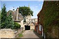
Church Gate
Narrow lane approaching St.Mary Magdalene's church from Wood Street
Image: © Richard Croft
Taken: 23 Aug 2007
0.06 miles
6
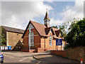
Geddington Church of England Primary School, Wood Street
Image: © David Dixon
Taken: 18 Sep 2017
0.06 miles
7
![Geddington buildings [3]](https://s3.geograph.org.uk/geophotos/07/12/79/7127983_1825d458_120x120.jpg)
Geddington buildings [3]
This delightful Victorian building is part of the Geddington Church of England Primary School.
Geddington is a village in Northamptonshire, on the main road between Kettering, about 3 miles southwest, and Corby, about 4 miles north. The River Ise runs through the village and is crossed by a medieval bridge. There is evidence of Iron Age, Roman and Saxon occupation. The village is home to the best preserved Eleanor cross of the three remaining. A Royal hunting lodge once stood to the north of the village but no trace remains.
Image: © Michael Dibb
Taken: 26 Sep 2021
0.06 miles
8
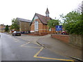
Geddington, primary school
Geddington Church of England Primary School, on Wood Street; the building is dated 1898: http://www.geddingtonschool.co.uk/
Image: © Mike Faherty
Taken: 11 May 2014
0.06 miles
9
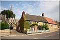
Wood Street cottage
Cottage on the corner of Wood Street and Church Gate
Image: © Richard Croft
Taken: 23 Aug 2007
0.07 miles
10
![Geddington houses [31]](https://s0.geograph.org.uk/geophotos/07/12/79/7127972_17dce677_120x120.jpg)
Geddington houses [31]
Once incorporating a shop, number 1 Wood Street is now purely residential. Built in the 17th and 18th centuries with later alterations. The front range is of coursed limestone rubble stone, the rear wing is of red brick. The roof is of concrete tiles, with slate to the rear of the front block. Listed, grade II, with details at: https://historicengland.org.uk/listing/the-list/list-entry/1372383
Geddington is a village in Northamptonshire, on the main road between Kettering, about 3 miles southwest, and Corby, about 4 miles north. The River Ise runs through the village and is crossed by a medieval bridge. There is evidence of Iron Age, Roman and Saxon occupation. The village is home to the best preserved Eleanor cross of the three remaining. A Royal hunting lodge once stood to the north of the village but no trace remains.
Image: © Michael Dibb
Taken: 26 Sep 2021
0.07 miles