
IMAGES TAKEN NEAR TO
Ladys Lane, NORTHAMPTON, NN1 3AH
Introduction
This page details the photographs taken nearby to Ladys Lane, NN1 3AH by members of the Geograph project.
The Geograph project started in 2005 with the aim of publishing, organising and preserving representative images for every square kilometre of Great Britain, Ireland and the Isle of Man.

There are currently over 7.5m images from over14,400 individuals and you can help contribute to the project by visiting https://www.geograph.org.uk
Image Map
Images are licensed for reuse under creativecommons.org/licenses/by-sa/2.0
Notes
- Clicking on the map will re-center to the selected point.
- The higher the marker number, the further away the image location is from the centre of the postcode.
Image Listing (152 Images Found)
Images are licensed for reuse under creativecommons.org/licenses/by-sa/2.0
Image
Details
Distance
1
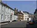
Sheep Street
One of the few streets to the north of the Market Place to have survived with older buildings intact. All those on the left, with the exception of the furthest, modern, one, are Listed Grade II, dating from the 18th century.
Image: © Alan Murray-Rust
Taken: 3 Aug 2011
0.01 miles
2
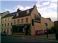
Wok Inn
This Chinese restaurant has been here for many years.
Image: © Burgess Von Thunen
Taken: 27 Aug 2010
0.05 miles
4
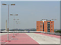
NEWLIFE (2)
The top level of the Mayorhold multi-storey car park, with tower block and the Express Lifts Tower.
Image: © Alan Murray-Rust
Taken: 3 Aug 2011
0.06 miles
5
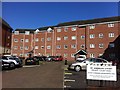
St Andrews Court
2000s flats in Spring Boroughs.
Image: © Burgess Von Thunen
Taken: 2 May 2013
0.06 miles
6
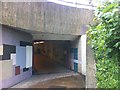
Northampton
This inviting subway lures pedestrians into Mayorhold car park.
Image: © Burgess Von Thunen
Taken: 16 May 2013
0.07 miles
7
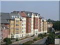
Modern housing
Medium-rise development on Broad Street, seen from the Mayorhold car park.
Image: © Alan Murray-Rust
Taken: 3 Aug 2011
0.07 miles
8
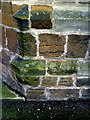
Benchmark on St Sepulchre's Church
Ordnance Survey 1GL bolt benchmark described on the Bench Mark Database at http://www.bench-marks.org.uk/bm25997
Image: © Roger Templeman
Taken: 4 Apr 2010
0.08 miles
9
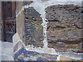
Benchmark on St Sepulchre's Church
This bench mark was established in 1852 during the First primary levelling of England & Wales, and was levelled with a height of 273.9790 feet [83.5088 metres] above mean sea level (Liverpool datum). It was included as a side level on the Towcester to King's Lynn levelling line. The surveyor's description was "No. 34(b). St Sepulchre's Church. Bolt in South-west angle of tower ; 1.85 ft. above surface" (Public Abstract p.310). The 1887 map shows this benchmark on the west face of the church, just south of the main entrance. It is rather small for a 19th-century mark, but of similar size to others nearby.
Image: © Shantavira
Taken: 16 May 2015
0.08 miles
10
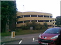
Mayorhold Car Park
Utilitarian architecture in the centre of town.
Image: © Burgess Von Thunen
Taken: 27 Aug 2010
0.08 miles