
IMAGES TAKEN NEAR TO
Litchborough Road, TOWCESTER, NN12 8EY
Introduction
This page details the photographs taken nearby to Litchborough Road, NN12 8EY by members of the Geograph project.
The Geograph project started in 2005 with the aim of publishing, organising and preserving representative images for every square kilometre of Great Britain, Ireland and the Isle of Man.

There are currently over 7.5m images from over14,400 individuals and you can help contribute to the project by visiting https://www.geograph.org.uk
Image Map
Images are licensed for reuse under creativecommons.org/licenses/by-sa/2.0
Notes
- Clicking on the map will re-center to the selected point.
- The higher the marker number, the further away the image location is from the centre of the postcode.
Image Listing (11 Images Found)
Images are licensed for reuse under creativecommons.org/licenses/by-sa/2.0
Image
Details
Distance
1
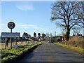
Entering Farthingstone on Litchborough Road
The small signs advertise 'Christmas in the Cloisters', but it was the previous evening.
Image: © Robin Webster
Taken: 4 Dec 2016
0.04 miles
2
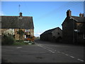
Farthingstone Main Street
Left for Weedon and straight ahead for Litchborough.
Image: © Ian Rob
Taken: 6 Nov 2010
0.14 miles
3
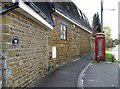
Longwall House, Farthingstone
The appropriately named Longwall House. The wall has seen many repairs and additions, but all in the local ironstone.
Image: © Graham Horn
Taken: 26 Apr 2007
0.14 miles
4
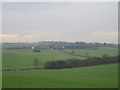
Macmillan Way footpath near Stowe Lodge
Heading south towards Farthingstone on the Macmillan Way. No path has been established yet through the crops in this field. In the next field the farmer has made a track.
Image: © John Winterbottom
Taken: 5 Jan 2006
0.19 miles
5
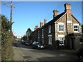
Farthingstone Main Street
Cottages in Main Street.
Image: © Ian Rob
Taken: 6 Nov 2010
0.22 miles
6
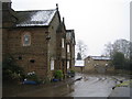
The Kings Arms, Farthingstone
Sadly not open at lunchtime on weekdays. Looking east at the road junction.
Image: © John Winterbottom
Taken: 23 Feb 2006
0.22 miles
7
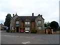
The Kings Arms, Farthingstone
Built in C19. See http://www.britishlistedbuildings.co.uk/en-360557-kings-arms-public-house-farthingstone-no#.Vd93nvlViko for entry in British Listed Buildings
Image: © Bikeboy
Taken: 20 Aug 2015
0.22 miles
8
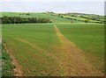
Footpath across England
Looking north-east from the point at which this footpath meets the road in Farthingstone. This footpath is the Macmillan Way, a 290-mile coast-to-coast path from Lincolnshire (in front) to Dorset (behind). Oh that they were all as clear on the ground as this.
Image: © Graham Horn
Taken: 26 Apr 2007
0.23 miles
9
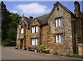
The King's Arms, Farthingstone
Well technically now the former King's Arms. It appears to be no longer a pub. The sign is certainly very faded. Compare John Winterbottom's picture 14 months previously Image The pane of glass in the lower right window is not broken; it is a revolving opening cleverly fitting into the diamond-shaped frames.
Image: © Graham Horn
Taken: 26 Apr 2007
0.23 miles
10
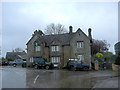
The Kings Arms
I can add to the debate as to where this excellent pub is open or not. Well it's been here since the 18th C and yes it is open. Yes it does take credit cards now. Yes it serves very good beer. Yes it has a warm welcome, although the fire wasn't lit on this gloomy day. Yes it has good wholesome pub food and yes I shall go there again. See also: http://www.thegoodpubguide.co.uk/pub/view/Kings-Arms-NN12-8EZ
Image: © Stuart Logan
Taken: 28 Apr 2012
0.24 miles