
IMAGES TAKEN NEAR TO
Bury Hill, TOWCESTER, NN12 8EG
Introduction
This page details the photographs taken nearby to Bury Hill, NN12 8EG by members of the Geograph project.
The Geograph project started in 2005 with the aim of publishing, organising and preserving representative images for every square kilometre of Great Britain, Ireland and the Isle of Man.

There are currently over 7.5m images from over14,400 individuals and you can help contribute to the project by visiting https://www.geograph.org.uk
Image Map
Images are licensed for reuse under creativecommons.org/licenses/by-sa/2.0
Notes
- Clicking on the map will re-center to the selected point.
- The higher the marker number, the further away the image location is from the centre of the postcode.
Image Listing (6 Images Found)
Images are licensed for reuse under creativecommons.org/licenses/by-sa/2.0
Image
Details
Distance
1
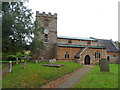
St Michael, Bradden
This church was built in 1858 but incorporated elements from the earlier C13-C15 church which stood here.
Image: © Bikeboy
Taken: 20 Aug 2015
0.14 miles
2
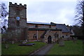
St Michael's, Bradden
A rather stripy church.
Image: © Andrew Smith
Taken: 26 Mar 2006
0.19 miles
3
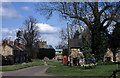
A quiet corner of south Northamptonshire
The village of Bradden and St.Michael's church on a fine April day.
Image: © Greg Fitchett
Taken: 14 Apr 2001
0.19 miles
4
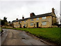
Cottages by the Church in Bradden
These cottages next to the village church are constructed out of local honey coloured stone.
Image: © Nigel Mykura
Taken: 9 Mar 2018
0.20 miles
5
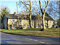
Cottages, Bradden
Facing a green rather spoilt by the unchecked growth of Ash.
Image: © Robin Webster
Taken: 4 Dec 2016
0.21 miles
