IMAGES TAKEN NEAR TO
Caldecote, TOWCESTER, NN12 8AG
Introduction
This page details the photographs taken nearby to NN12 8AG by members of the Geograph project.
The Geograph project started in 2005 with the aim of publishing, organising and preserving representative images for every square kilometre of Great Britain, Ireland and the Isle of Man.

There are currently over 7.5m images from over14,400 individuals and you can help contribute to the project by visiting https://www.geograph.org.uk
Image Map (Loading...)


Getting Data...Please wait
Leaflet Map data © OpenStreetMap
Images are licensed for reuse under creativecommons.org/licenses/by-sa/2.0
Notes
- Clicking on the map will re-center to the selected point.
- The higher the marker number, the further away the image location is from the centre of the postcode.
Image Listing (9 Images Found)
Images are licensed for reuse under creativecommons.org/licenses/by-sa/2.0
Image
Details
Distance
2
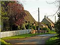
Caldecote
A small hamlet of cottages, some thatched, on the narrow lane between Tiffield and the A5.
Image: © Stephen McKay
Taken: 4 Nov 2006
0.04 miles
4
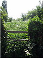
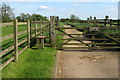
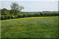
Little used footpath out of Caldecote
Image: © Philip Jeffrey
Taken: 1 Jun 2013
0.06 miles