
IMAGES TAKEN NEAR TO
Belle Baulk, TOWCESTER, NN12 6YE
Introduction
This page details the photographs taken nearby to Belle Baulk, NN12 6YE by members of the Geograph project.
The Geograph project started in 2005 with the aim of publishing, organising and preserving representative images for every square kilometre of Great Britain, Ireland and the Isle of Man.

There are currently over 7.5m images from over14,400 individuals and you can help contribute to the project by visiting https://www.geograph.org.uk
Image Map
Images are licensed for reuse under creativecommons.org/licenses/by-sa/2.0
Notes
- Clicking on the map will re-center to the selected point.
- The higher the marker number, the further away the image location is from the centre of the postcode.
Image Listing (12 Images Found)
Images are licensed for reuse under creativecommons.org/licenses/by-sa/2.0
Image
Details
Distance
1
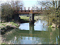
Rusty railway bridge near Towcester
Disused and rusty railway bridge (dated 1864) over the river that becomes Broad Water, flowing through Easton Neston Park. The A43 bridge can be seen in the background.
Image: © Oliver Hunter
Taken: 14 Apr 2006
0.14 miles
3
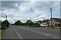
Brackley Road
Looking west along Brackley Road on the outskirts of Towcester.
Image: © DS Pugh
Taken: 29 May 2022
0.20 miles
4
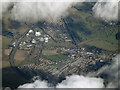
Towcester from the air
Retail establishments clustered around Tove Roundabout on the A43 to the west of the town. Viewed from a Birmingham bound flight from Prague.
Image: © Thomas Nugent
Taken: 11 Feb 2022
0.20 miles
5
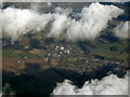
Towcester from the air
Retail establishments clustered around Tove Roundabout on the A43 to the west of the town. Viewed from a Birmingham bound flight from Prague.
Image: © Thomas Nugent
Taken: 11 Feb 2022
0.20 miles

7
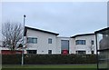
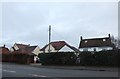
Modern house on Brackley Road, Towcester
Image: © David Howard
Taken: 28 Dec 2019
0.21 miles
8
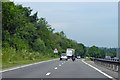
A43 towards Northampton
Skirting around Towcester which is to the right.
Image: © Robin Webster
Taken: 23 Jun 2019
0.23 miles
10
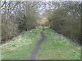
Footpath along disused railway embankment
Looking southwest along the old railway embankment across the A5 from Tesco.
Image: © Oliver Hunter
Taken: 14 Apr 2006
0.24 miles