IMAGES TAKEN NEAR TO
Highfield Place, DAVENTRY, NN11 9BF
Introduction
This page details the photographs taken nearby to Highfield Place, NN11 9BF by members of the Geograph project.
The Geograph project started in 2005 with the aim of publishing, organising and preserving representative images for every square kilometre of Great Britain, Ireland and the Isle of Man.

There are currently over 7.5m images from over14,400 individuals and you can help contribute to the project by visiting https://www.geograph.org.uk
Image Map
Images are licensed for reuse under creativecommons.org/licenses/by-sa/2.0
Notes
- Clicking on the map will re-center to the selected point.
- The higher the marker number, the further away the image location is from the centre of the postcode.
Image Listing (18 Images Found)
Images are licensed for reuse under creativecommons.org/licenses/by-sa/2.0
Image
Details
Distance
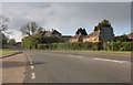
6
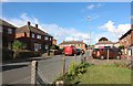
A45 Braunston Road, Daventry
The A45 in Daventry coming towards the roundabout for the town centre and the other way which the A45 route carrying on towards Weedon and Northampton.
Image: © Jareth W
Taken: 5 May 2014
0.14 miles
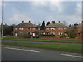
8
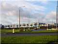
Daventry
North Eastern End of Cummins Diesel Engine Plant taken from east of traffic island.
Image: © Ian Rob
Taken: 16 Dec 2005
0.15 miles
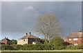
9
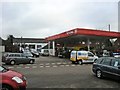
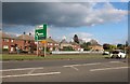
Daventry-Maple Leaf Garage
Car sales and repairs, and a filling station.
Image: © Ian Rob
Taken: 11 Jan 2011
0.15 miles
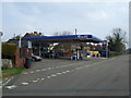
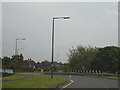
10
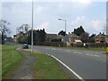
Braunston Road (A45), Daventry
Heading north west towards Rugby.
Image: © JThomas
Taken: 28 Mar 2014
0.16 miles