IMAGES TAKEN NEAR TO
Church Road, DAVENTRY, NN11 7HG
Introduction
This page details the photographs taken nearby to Church Road, NN11 7HG by members of the Geograph project.
The Geograph project started in 2005 with the aim of publishing, organising and preserving representative images for every square kilometre of Great Britain, Ireland and the Isle of Man.

There are currently over 7.5m images from over14,400 individuals and you can help contribute to the project by visiting https://www.geograph.org.uk
Image Map
Images are licensed for reuse under creativecommons.org/licenses/by-sa/2.0
Notes
- Clicking on the map will re-center to the selected point.
- The higher the marker number, the further away the image location is from the centre of the postcode.
Image Listing (54 Images Found)
Images are licensed for reuse under creativecommons.org/licenses/by-sa/2.0
Image
Details
Distance
1
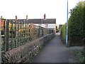
Braunston Footpath
Leading from Church Road to High Street.
Image: © Ian Rob
Taken: 8 Feb 2011
0.04 miles
2
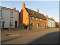
Braunston High Street
The footpath is raised at this point.
Image: © Ian Rob
Taken: 8 Feb 2011
0.04 miles
3
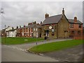
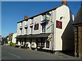
Braunston-Wheatsheaf Inn
Pub and adjoining cottages on The Green.
Image: © Ian Rob
Taken: 1 Mar 2011
0.04 miles
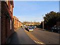
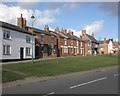
5
Braunston High Street
Evening sunlight on High Street.
Image: © Ian Rob
Taken: 8 Feb 2011
0.06 miles
6
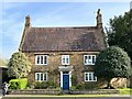
Ash Tree House, Braunston
Grade II listed. Listing number 1366614.
Image: © Andrew Abbott
Taken: 3 May 2023
0.07 miles
7
The Old Plough
On Braunston High Street.
Image: © Graham Hogg
Taken: 24 May 2011
0.08 miles
8
Braunston
Wheatsheaf Pub on corner of Barby Lane
Image: © Ian Rob
Taken: 12 Sep 2005
0.09 miles
9
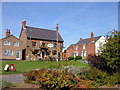
Houses on the village green, Braunston
Image: © Roger Cornfoot
Taken: 8 Oct 2013
0.09 miles
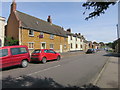
10
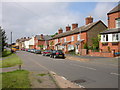
Braunston High Street
Cottages on High Street near the Green.
Image: © Ian Rob
Taken: 29 May 2008
0.09 miles