
IMAGES TAKEN NEAR TO
Newnham Road, DAVENTRY, NN11 4FR
Introduction
This page details the photographs taken nearby to Newnham Road, NN11 4FR by members of the Geograph project.
The Geograph project started in 2005 with the aim of publishing, organising and preserving representative images for every square kilometre of Great Britain, Ireland and the Isle of Man.

There are currently over 7.5m images from over14,400 individuals and you can help contribute to the project by visiting https://www.geograph.org.uk
Image Map
Images are licensed for reuse under creativecommons.org/licenses/by-sa/2.0
Notes
- Clicking on the map will re-center to the selected point.
- The higher the marker number, the further away the image location is from the centre of the postcode.
Image Listing (6 Images Found)
Images are licensed for reuse under creativecommons.org/licenses/by-sa/2.0
Image
Details
Distance
1
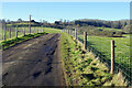
Lane to Daventry
The appalling state of the surface of this lane can be seen in this picture. Motorists have to take care to avoid potholes and the uneven nature could result in grounding. In the distance on Borough Hill is the one remaining mast that comprises Daventry transmitting station (there were 40 at one time) - nowadays transmitting DAB radio services.
Image: © Stephen McKay
Taken: 17 Jan 2022
0.08 miles
2

Lane to Norton
The low winter sunshine just after noon on this January day has created strong shadows of the wooden fence and, a little further along, the trees. This photograph was taken from the end of the drive to Dry Fields Farm.
Image: © Stephen McKay
Taken: 17 Jan 2022
0.09 miles
3

View from close to Dry Fields Farm
Looking across the undulating countryside to the east of Daventry with the lane to Norton leading away to the left.
Image: © Stephen McKay
Taken: 17 Jan 2022
0.09 miles
4
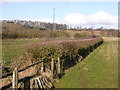
Norton
Field close to Borough Hill Farm on road to Norton.
Image: © Ian Rob
Taken: 25 Feb 2006
0.12 miles
5
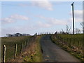
Daventry-Norton Road
The single track road from the A45 to Norton.
Image: © Ian Rob
Taken: 25 Feb 2006
0.12 miles
6
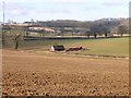
Norton
Farm buildings seen from the road to Dodford.
Image: © Ian Rob
Taken: 25 Feb 2006
0.23 miles