IMAGES TAKEN NEAR TO
High March Close, DAVENTRY, NN11 4EZ
Introduction
This page details the photographs taken nearby to High March Close, NN11 4EZ by members of the Geograph project.
The Geograph project started in 2005 with the aim of publishing, organising and preserving representative images for every square kilometre of Great Britain, Ireland and the Isle of Man.

There are currently over 7.5m images from over14,400 individuals and you can help contribute to the project by visiting https://www.geograph.org.uk
Image Map (Loading...)


Getting Data...Please wait
Leaflet Map data © OpenStreetMap
Images are licensed for reuse under creativecommons.org/licenses/by-sa/2.0
Notes
- Clicking on the map will re-center to the selected point.
- The higher the marker number, the further away the image location is from the centre of the postcode.
Image Listing (11 Images Found)
Images are licensed for reuse under creativecommons.org/licenses/by-sa/2.0
Image
Details
Distance
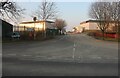
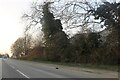
1
A425 South Way, Daventry
Heading north.
Image: © Robin Webster
Taken: 18 Jul 2021
0.08 miles
2
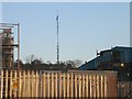
Daventry
High March Industrial Estate. BBC Transmitter can be seen in north east corner of this Square.
Image: © Ian Rob
Taken: Unknown
0.08 miles
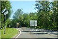
4
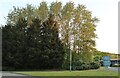
Wooded roundabout on South Way, Daventry
Image: © David Howard
Taken: 21 May 2023
0.16 miles
5
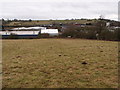
Daventry industrial area
Newnham Hill is in the distance.
Image: © Michael Trolove
Taken: 3 Feb 2013
0.17 miles
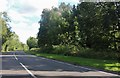
6
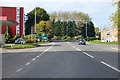
A45 nearing roundabout at start of Daventry bypass
The latest Daventry bypass is a left turn at the roundabout.
Image: © Robin Webster
Taken: 20 Oct 2018
0.19 miles
7
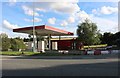
Derelict petrol station on London Road, Daventry
Image: © David Howard
Taken: 2 Aug 2020
0.21 miles
9

Overgrown and wet bridleway
A lightly used bridleway near Daventry.
Image: © Michael Trolove
Taken: 3 Feb 2013
0.23 miles