IMAGES TAKEN NEAR TO
Newman Street, RUSHDEN, NN10 8JW
Introduction
This page details the photographs taken nearby to Newman Street, NN10 8JW by members of the Geograph project.
The Geograph project started in 2005 with the aim of publishing, organising and preserving representative images for every square kilometre of Great Britain, Ireland and the Isle of Man.

There are currently over 7.5m images from over14,400 individuals and you can help contribute to the project by visiting https://www.geograph.org.uk
Image Map
Images are licensed for reuse under creativecommons.org/licenses/by-sa/2.0
Notes
- Clicking on the map will re-center to the selected point.
- The higher the marker number, the further away the image location is from the centre of the postcode.
Image Listing (11 Images Found)
Images are licensed for reuse under creativecommons.org/licenses/by-sa/2.0
Image
Details
Distance
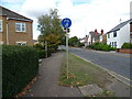
2

Yarn bombed George V postbox on Windmill Banks
Postbox No. NN10 37.
Image: © JThomas
Taken: 23 Sep 2022
0.13 miles
3
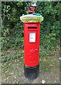
Yarn bombed George V postbox on Windmill Banks
Postbox No. NN10 37.
Image: © JThomas
Taken: 23 Sep 2022
0.14 miles
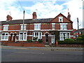
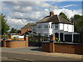
6
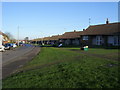
Elizabeth Way
Bungalows on Elizabeth Way
Image: © Shaun Ferguson
Taken: 10 Dec 2008
0.15 miles
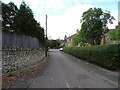
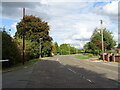
8
Saffron Road, Higham Ferrers
This section of the road still resembles a cart track. There used to be a farm to the right and fields to the left. Both have been replaced by housing. The highway authority has so far resisted suggestions that the road be brought up to urban standard with street-lights and tarmac.
Image: © Will Lovell
Taken: 9 May 2006
0.18 miles