
IMAGES TAKEN NEAR TO
Dryden Way, RUSHDEN, NN10 8DH
Introduction
This page details the photographs taken nearby to Dryden Way, NN10 8DH by members of the Geograph project.
The Geograph project started in 2005 with the aim of publishing, organising and preserving representative images for every square kilometre of Great Britain, Ireland and the Isle of Man.

There are currently over 7.5m images from over14,400 individuals and you can help contribute to the project by visiting https://www.geograph.org.uk
Image Map
Images are licensed for reuse under creativecommons.org/licenses/by-sa/2.0
Notes
- Clicking on the map will re-center to the selected point.
- The higher the marker number, the further away the image location is from the centre of the postcode.
Image Listing (5 Images Found)
Images are licensed for reuse under creativecommons.org/licenses/by-sa/2.0
Image
Details
Distance
1
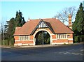
Cemetery Gates
The entrance to Higham Ferrers cemetery is found at the junction of Cemetery Lane, Vine Hill Drive and Saffron Road.
Image: © Will Lovell
Taken: 12 Dec 2005
0.12 miles
2
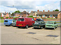
Higham Auto Services, Higham Ferrers
A general purpose garage and petrol filling station on Northampton Road, that also specialises in restoration work on classic Hillman Imps and their derivatives - hence this line up on the forecourt.
Image: © Stephen McKay
Taken: 28 Jun 2008
0.21 miles
3
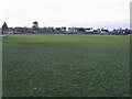
Saffron Road Recreation Ground
From Vine Hill Drive looking to the Saffron Road Recreation Ground
Image: © Shaun Ferguson
Taken: 10 Dec 2008
0.23 miles
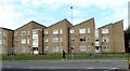
5
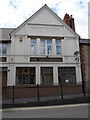
The Swan
A former public house with a fine detailed gable end wall. Believed to be a restaurant at the time of writing.
Image: © Michael Trolove
Taken: 9 Jul 2011
0.25 miles