IMAGES TAKEN NEAR TO
Southfields, RUSHDEN, NN10 0BY
Introduction
This page details the photographs taken nearby to Southfields, NN10 0BY by members of the Geograph project.
The Geograph project started in 2005 with the aim of publishing, organising and preserving representative images for every square kilometre of Great Britain, Ireland and the Isle of Man.

There are currently over 7.5m images from over14,400 individuals and you can help contribute to the project by visiting https://www.geograph.org.uk
Image Map
Images are licensed for reuse under creativecommons.org/licenses/by-sa/2.0
Notes
- Clicking on the map will re-center to the selected point.
- The higher the marker number, the further away the image location is from the centre of the postcode.
Image Listing (24 Images Found)
Images are licensed for reuse under creativecommons.org/licenses/by-sa/2.0
Image
Details
Distance
1
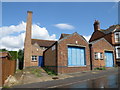
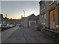
Works on Harborough Road
Joinery works, apologies for the bendy chimney, need a more expensive camera to accommodate wide angles with straight edges.
Image: © Michael Trolove
Taken: 9 Jul 2011
0.06 miles
2
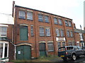
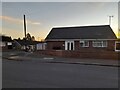
Leather works on Harborough Road
The sign says Clifford Collins Leather Manufacturers but is not believed to be in use. The accompanying link is a historical walk up or down Harborough Road in 1993
http://www.rushdenheritage.co.uk/history/HarboroughRoadSurvey1993.html
Image: © Michael Trolove
Taken: 9 Jul 2011
0.06 miles
5
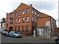
Former Shoe factory, York Road
Now converted to flats, an interesting link of how a fire at the premises in 1907 was dealt with http://www.rushdenheritage.co.uk/crime/EllardandHowes-fire.html
Image: © Michael Trolove
Taken: 9 Jul 2011
0.12 miles
7
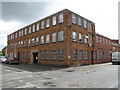
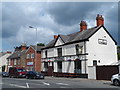
Factory on Roberts Street
Shoe or leather works or other. Looks to be in use with modernised windows. A fantastic reference to the shoe trade can be found here http://www.rushdenheritage.co.uk/shoetrade/index-shoetrade.html
Image: © Michael Trolove
Taken: 9 Jul 2011
0.14 miles
8
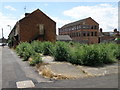
Bare ground on Grove Road
The site of a demolished building possibly a shoe or leather factory.
Update, thanks to Nick Hill who has informed me that-
This was actually the site of the former Rushden Town Band Club, gutted in a fire in the early hours of January 2nd, 2006.
Image: © Michael Trolove
Taken: 9 Jul 2011
0.15 miles