
IMAGES TAKEN NEAR TO
Brookhill Street, NOTTINGHAM, NG9 7BQ
Introduction
This page details the photographs taken nearby to Brookhill Street, NG9 7BQ by members of the Geograph project.
The Geograph project started in 2005 with the aim of publishing, organising and preserving representative images for every square kilometre of Great Britain, Ireland and the Isle of Man.

There are currently over 7.5m images from over14,400 individuals and you can help contribute to the project by visiting https://www.geograph.org.uk
Image Map
Images are licensed for reuse under creativecommons.org/licenses/by-sa/2.0
Notes
- Clicking on the map will re-center to the selected point.
- The higher the marker number, the further away the image location is from the centre of the postcode.
Image Listing (45 Images Found)
Images are licensed for reuse under creativecommons.org/licenses/by-sa/2.0
Image
Details
Distance
1
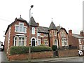
60 and 62 Brookhill Street, Stapleford
Monrepos from 1888
Image: © Andrew Abbott
Taken: 28 Dec 2019
0.03 miles
2
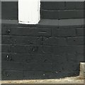
Bench mark, 53 Brookhill Street, Stapleford
See http://www.geograph.org.uk/photo/5808703 for location.
Image: © Alan Murray-Rust
Taken: 12 Jun 2018
0.05 miles
3
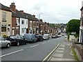
Brookhill Street, Stapleford
Looking down towards Derby Road.
Image: © Alan Murray-Rust
Taken: 12 Jun 2018
0.05 miles
4
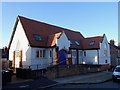
St. Andrew's House
St. Andrew's church closed as a Church of England place of worship in 2005. It then became The Haven Church and Community Centre, before being taken over by the Framework charity and converted into flats.
Image: © Ian Calderwood
Taken: 18 Nov 2018
0.05 miles
5
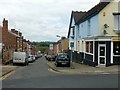
Lawrence Street, Stapleford
There is a bench mark http://www.geograph.org.uk/photo/5808702 to the left of the door into the takeaway on the right.
Image: © Alan Murray-Rust
Taken: 12 Jun 2018
0.06 miles
6
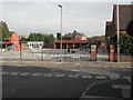
William Lilley Nursery School
located on Halls Road, Stapleford. This is the playground at 08.45hrs. Ten minutes later it was packed.
Image: © Tom Courtney
Taken: 9 Sep 2005
0.07 miles
7
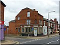
The corner of West End Street and Derby Road, Stapleford
The building was formerly a bank.
Image: © Alan Murray-Rust
Taken: 12 Jun 2018
0.08 miles
8
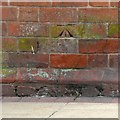
Bench mark, West End Club, Derby Road, Stapleford
See http://www.geograph.org.uk/photo/5808695 for location.
Image: © Alan Murray-Rust
Taken: 12 Jun 2018
0.08 miles
9
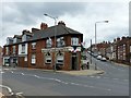
West End Club, Derby Road, Stapleford
Built as a bank but it has been the West End Club since at least the 1950s. There is a bench mark http://www.geograph.org.uk/photo/5808696 to the left of the doorway.
Image: © Alan Murray-Rust
Taken: 12 Jun 2018
0.08 miles
10
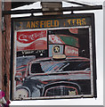
West End Club on Derby Road, Stapleford
A former social club now a public house. http://www.geograph.org.uk/photo/5040843 http://www.geograph.org.uk/photo/5040834
Image: © Ian S
Taken: 16 Jul 2016
0.08 miles