IMAGES TAKEN NEAR TO
Water Orton Close, NOTTINGHAM, NG9 6LQ
Introduction
This page details the photographs taken nearby to Water Orton Close, NG9 6LQ by members of the Geograph project.
The Geograph project started in 2005 with the aim of publishing, organising and preserving representative images for every square kilometre of Great Britain, Ireland and the Isle of Man.

There are currently over 7.5m images from over14,400 individuals and you can help contribute to the project by visiting https://www.geograph.org.uk
Image Map
Images are licensed for reuse under creativecommons.org/licenses/by-sa/2.0
Notes
- Clicking on the map will re-center to the selected point.
- The higher the marker number, the further away the image location is from the centre of the postcode.
Image Listing (66 Images Found)
Images are licensed for reuse under creativecommons.org/licenses/by-sa/2.0
Image
Details
Distance
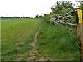
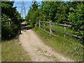
6
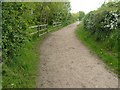
Path at Toton to the Railway sidings and Long Eaton
Image: © Andy Jamieson
Taken: 10 May 2009
0.07 miles
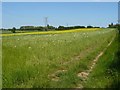
7
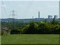
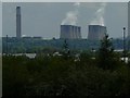
Toton,view of the Power station at Ratcliffe
Image: © Andy Jamieson
Taken: 31 May 2009
0.08 miles
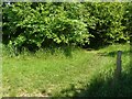
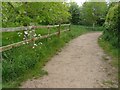
8
From Path at Toton to the Railway sidings and Long Eaton
Ratcliffe on Soar power station
Image: © Andy Jamieson
Taken: 10 May 2009
0.08 miles
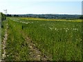
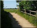
9
Path at Toton to the Railway sidings and Long Eaton
Image: © Andy Jamieson
Taken: 10 May 2009
0.08 miles