IMAGES TAKEN NEAR TO
Aldridge Close, NOTTINGHAM, NG9 6JA
Introduction
This page details the photographs taken nearby to Aldridge Close, NG9 6JA by members of the Geograph project.
The Geograph project started in 2005 with the aim of publishing, organising and preserving representative images for every square kilometre of Great Britain, Ireland and the Isle of Man.

There are currently over 7.5m images from over14,400 individuals and you can help contribute to the project by visiting https://www.geograph.org.uk
Image Map
Images are licensed for reuse under creativecommons.org/licenses/by-sa/2.0
Notes
- Clicking on the map will re-center to the selected point.
- The higher the marker number, the further away the image location is from the centre of the postcode.
Image Listing (82 Images Found)
Images are licensed for reuse under creativecommons.org/licenses/by-sa/2.0
Image
Details
Distance
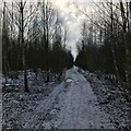
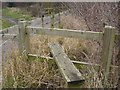
3
Path leading down to the tracks near the sidings
Image: © Andy Jamieson
Taken: 7 Jan 2009
0.10 miles
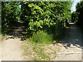
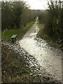
6

Power line across Toton Fields
With a major source of power - Ratcliffe-0n-Soar power station - in view.
Image: © David Lally
Taken: 19 Jan 2021
0.11 miles
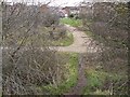
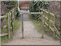
8
Footpath to Long Eaton
Passing down the western side of the Banks Road housing estate. The narrow green corridor between the housing and the former railway sidings or the River Erewash is a designated Local Nature Reserve.
Image: © Alan Murray-Rust
Taken: 13 Jan 2023
0.12 miles
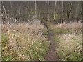
9
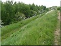
Path by Toton sidings looking at the Silver Birch wood
Image: © Andy Jamieson
Taken: 10 May 2009
0.12 miles