IMAGES TAKEN NEAR TO
Park Road, NOTTINGHAM, NG9 4DA
Introduction
This page details the photographs taken nearby to Park Road, NG9 4DA by members of the Geograph project.
The Geograph project started in 2005 with the aim of publishing, organising and preserving representative images for every square kilometre of Great Britain, Ireland and the Isle of Man.

There are currently over 7.5m images from over14,400 individuals and you can help contribute to the project by visiting https://www.geograph.org.uk
Image Map
Images are licensed for reuse under creativecommons.org/licenses/by-sa/2.0
Notes
- Clicking on the map will re-center to the selected point.
- The higher the marker number, the further away the image location is from the centre of the postcode.
Image Listing (528 Images Found)
Images are licensed for reuse under creativecommons.org/licenses/by-sa/2.0
Image
Details
Distance
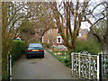
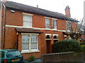
1
26 Park Road, Chilwell
In the Cottage Grove Conservation Area.
Image: © Andrew Abbott
Taken: 6 Apr 2020
0.01 miles
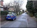
3
Park Road, Beeston
View of Park Road in Beeston looking south. This street is part of a conservation area.
Image: © Andrew Abbott
Taken: 24 Mar 2010
0.02 miles
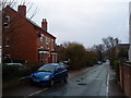
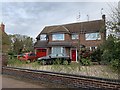
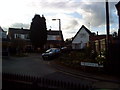
4
Park Road, Chilwell
The narrow roads in this area were developed from around 1885 before any thought for the needs of motorised traffic.
Image: © Alan Murray-Rust
Taken: 22 Dec 2013
0.02 miles
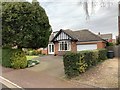
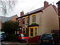
6
34 Park Road, Chilwell
In the Cottage Grove Conservation Area.
Image: © Andrew Abbott
Taken: 6 Apr 2020
0.02 miles
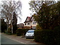
7
Park Road, Beeston
A courageous colour scheme.
Image: © Andrew Abbott
Taken: 12 Apr 2010
0.02 miles
8
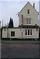
The Hop Pole, Beeston / Chilwell
Eagle Eyed viewers, may spot that the double road-name sign alludes to the fact that this pub straddles a border. To the left is High Road, Chilwell to the right Chilwell Road, Beeston.
This leads to the tail that in the past, when each of these settlements were under different local government (they are now both in The Borough of Broxtowe) there was a different closing time in the two areas. As a result there was a nightly migration from one side of the bar to the other when one half of the establishment had to stop serving.
Whether there is any truth in this story I have no idea. It would have had to have happened before 1934, which is when Stapleford Rural District (containing Chilwell) was merged with Beeston Urban District to become Beeston & Stapleford Urban District - eliminating this border.
Unfortunately I was unable to get a satisfactory close-up of the sign due to a strategically placed parking sign.
Image: © David Lally
Taken: 16 Jan 2008
0.03 miles
9
Rookwood Close, Beeston
Housing on Rookwood Close, Beeston.
Image: © Andrew Abbott
Taken: 26 Mar 2010
0.03 miles