IMAGES TAKEN NEAR TO
Glenside Road, NOTTINGHAM, NG9 3EX
Introduction
This page details the photographs taken nearby to Glenside Road, NG9 3EX by members of the Geograph project.
The Geograph project started in 2005 with the aim of publishing, organising and preserving representative images for every square kilometre of Great Britain, Ireland and the Isle of Man.

There are currently over 7.5m images from over14,400 individuals and you can help contribute to the project by visiting https://www.geograph.org.uk
Image Map
Images are licensed for reuse under creativecommons.org/licenses/by-sa/2.0
Notes
- Clicking on the map will re-center to the selected point.
- The higher the marker number, the further away the image location is from the centre of the postcode.
Image Listing (25 Images Found)
Images are licensed for reuse under creativecommons.org/licenses/by-sa/2.0
Image
Details
Distance
1
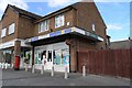
Bramcote Hills PO
On the published list for closure of 2 Oct 07
Image: © David Lally
Taken: 5 Oct 2007
0.07 miles
3
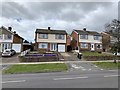
15 and 17 Thoresby Road
Detached houses
Image: © Andrew Abbott
Taken: 29 Mar 2020
0.12 miles
4
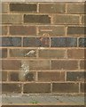
Bench mark, 81 Thoresby Road, Bramcote
See http://www.geograph.org.uk/photo/5159313 for location.
Image: © Alan Murray-Rust
Taken: 17 Oct 2016
0.14 miles
6
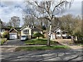
81 Thoresby Road, Bramcote
There is a bench mark http://www.geograph.org.uk/photo/5159311 on the forward facing gable.
Image: © Alan Murray-Rust
Taken: 17 Oct 2016
0.15 miles
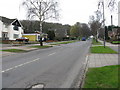
8
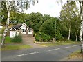
Thoresby Road, Bramcote
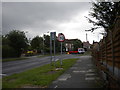
Seen from its junction with Derby Road, Thoresby Road provides an important suburban link to Wollaton. The small lorry is turning out of Arundel Drive.
Image: © Richard Vince
Taken: 7 Jul 2012
0.18 miles
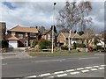
9
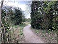
Alexandrina Plantation, Bramcote Hills
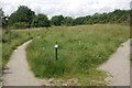
Alexandrina Plantation is a local nature reserve managed by Broxtowe Borough Council; the area is also known as Bramcote Hills or Bramcote Ridge. It is part of an east-west sandstone ridge that divides Wollaton and Bramcote and runs to the Erewash Valley in the west. Although surrounded by considerable suburban development, the hills have never been built on (being very steep in places) and are now protected. The signboard makes reference to a blue butterfly scheme in the surrounding grassland.
Image: © Stephen McKay
Taken: 1 Jul 2007
0.18 miles