IMAGES TAKEN NEAR TO
Burrows Crescent, NOTTINGHAM, NG9 2QX
Introduction
This page details the photographs taken nearby to Burrows Crescent, NG9 2QX by members of the Geograph project.
The Geograph project started in 2005 with the aim of publishing, organising and preserving representative images for every square kilometre of Great Britain, Ireland and the Isle of Man.

There are currently over 7.5m images from over14,400 individuals and you can help contribute to the project by visiting https://www.geograph.org.uk
Image Map
Images are licensed for reuse under creativecommons.org/licenses/by-sa/2.0
Notes
- Clicking on the map will re-center to the selected point.
- The higher the marker number, the further away the image location is from the centre of the postcode.
Image Listing (60 Images Found)
Images are licensed for reuse under creativecommons.org/licenses/by-sa/2.0
Image
Details
Distance
3
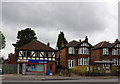
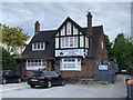
Betfred Betting Shop on Derby Road, Nottingham
Image: © Ian S
Taken: 16 Jul 2016
0.07 miles
4
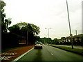
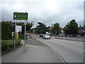
Derby Road near the Priory roundabout
Looking west along the A52.
Image: © David Lally
Taken: 14 Jul 2010
0.08 miles
5
Priory Veterinary Practice
10a Derby Road, Beeston
Image: © Andrew Abbott
Taken: 19 May 2020
0.10 miles
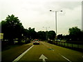
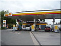
6
A1 motor stores
Near Priory Island on the A52 in Nottingham.
Image: © Andrew Abbott
Taken: 13 Nov 2016
0.10 miles
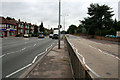
8
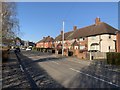
Houses on Brook Road
Opposite Abbey Court.
Image: © Andrew Abbott
Taken: 26 Mar 2020
0.11 miles
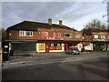
10
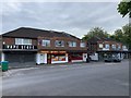
Priory Island shops
2-10 Derby Road, Beeston
Image: © Andrew Abbott
Taken: 19 May 2020
0.11 miles