IMAGES TAKEN NEAR TO
Waverley Avenue, NOTTINGHAM, NG9 1HZ
Introduction
This page details the photographs taken nearby to Waverley Avenue, NG9 1HZ by members of the Geograph project.
The Geograph project started in 2005 with the aim of publishing, organising and preserving representative images for every square kilometre of Great Britain, Ireland and the Isle of Man.

There are currently over 7.5m images from over14,400 individuals and you can help contribute to the project by visiting https://www.geograph.org.uk
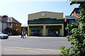
Image Map
Images are licensed for reuse under creativecommons.org/licenses/by-sa/2.0
Notes
- Clicking on the map will re-center to the selected point.
- The higher the marker number, the further away the image location is from the centre of the postcode.
Image Listing (890 Images Found)
Images are licensed for reuse under creativecommons.org/licenses/by-sa/2.0
Image
Details
Distance
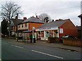
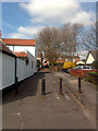
1
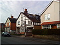
Waverley Avenue, Beeston
Enthusiastic home improvements!
Image: © Andrew Abbott
Taken: 9 Apr 2010
0.02 miles
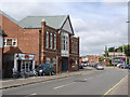
3
Beeston Conservative Club
Winston Churchill house on Station Road, Beeston
Image: © Andrew Abbott
Taken: 22 Mar 2010
0.04 miles
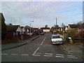
4
Waverley Avenue, Beeston
With only a few trees in some front gardens. Including the magnolia in the foreground just coming into flower.
Image: © David Lally
Taken: 31 Mar 2009
0.04 miles
5
W. Ginever Funeral Directors
The building was formerly occupied by Arden Winch (an industrial Health and Safety equipment supplier). The current tenants moved here after their former premises http://www.geograph.org.uk/search.php?i=50324420 was demolished for the NET tram line.
Image: © David Lally
Taken: 23 Jul 2014
0.04 miles
6
Canvas printing shop, Beeston
Canvas printing shop on Station Road, Beeston
Image: © Andrew Abbott
Taken: 22 Mar 2010
0.05 miles
7
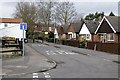
Bungalows at the north end of Waverley Avenue
Image: © David Lally
Taken: 7 Jan 2013
0.05 miles
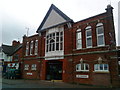
8
New Beeston Conservative Club
The building is various shown as 'Hall' and Warehouse' on old OS maps.
Image: © Alan Murray-Rust
Taken: 13 Sep 2013
0.05 miles
9
Moore Gate, Beeston
A pathway to Middle Street. The brick building in the centre of the frame is the back elevation of The Star http://www.geograph.org.uk/photo/924077.
Image: © David Lally
Taken: 31 Mar 2009
0.05 miles
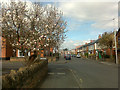
10
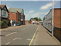
Station Road, Beeston
The large building on the left by the bend is the Beeston New Conservative Club. The building on the right is an Italian Restaurant.
Image: © David Lally
Taken: 1 Jul 2009
0.05 miles