IMAGES TAKEN NEAR TO
Strelley Road, NOTTINGHAM, NG8 3AY
Introduction
This page details the photographs taken nearby to Strelley Road, NG8 3AY by members of the Geograph project.
The Geograph project started in 2005 with the aim of publishing, organising and preserving representative images for every square kilometre of Great Britain, Ireland and the Isle of Man.

There are currently over 7.5m images from over14,400 individuals and you can help contribute to the project by visiting https://www.geograph.org.uk
Image Map
Images are licensed for reuse under creativecommons.org/licenses/by-sa/2.0
Notes
- Clicking on the map will re-center to the selected point.
- The higher the marker number, the further away the image location is from the centre of the postcode.
Image Listing (25 Images Found)
Images are licensed for reuse under creativecommons.org/licenses/by-sa/2.0
Image
Details
Distance
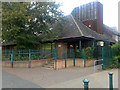
1
Bus stop and shelter on Strelley Road
Outside Broxtowe Children's Centre.
Image: © JThomas
Taken: 27 Mar 2017
0.02 miles
2
Broxtowe Children's Centre
Family support and activities for children under 5 and their families.
On Strelley Road.
Image: © JThomas
Taken: 27 Mar 2017
0.02 miles
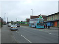
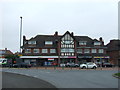
3
Co-op superstore, Strelley Road
After looking run down for quite a while, this supermarket has quite recently been refurbished. This is the Strelley Road frontage; its car park is out of frame to the left.
Image: © Richard Vince
Taken: 28 Mar 2013
0.05 miles
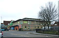
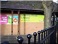
4
Strelley Road Library
Construction date unknown.
Image: © David Lally
Taken: 15 Sep 2009
0.06 miles
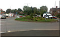
5
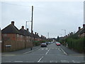
Junction of Beechdale Road and Strelley Road
Image: © Tom Courtney
Taken: 9 Sep 2005
0.06 miles
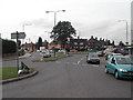
8
Dog-bone Roundabout
Taken from between Strelley Road and Beechdale Road. Broxtowe Lane is to the left, Aspley Lane to the right.
This is the opposing view to Image which shows two separate roundabouts, as the current 1:50,000 map still shows.
Image: © David Lally
Taken: 15 Sep 2009
0.07 miles
9
Fircroft Avenue
Looking west from Beechdale Road.
Image: © JThomas
Taken: 27 Mar 2017
0.08 miles
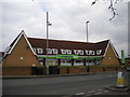
10
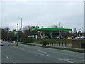
Supermarket service station on Strelley Road
Image: © JThomas
Taken: 27 Mar 2017
0.08 miles