IMAGES TAKEN NEAR TO
Monmouth Close, NOTTINGHAM, NG8 2JQ
Introduction
This page details the photographs taken nearby to Monmouth Close, NG8 2JQ by members of the Geograph project.
The Geograph project started in 2005 with the aim of publishing, organising and preserving representative images for every square kilometre of Great Britain, Ireland and the Isle of Man.

There are currently over 7.5m images from over14,400 individuals and you can help contribute to the project by visiting https://www.geograph.org.uk
Image Map
Images are licensed for reuse under creativecommons.org/licenses/by-sa/2.0
Notes
- Clicking on the map will re-center to the selected point.
- The higher the marker number, the further away the image location is from the centre of the postcode.
Image Listing (52 Images Found)
Images are licensed for reuse under creativecommons.org/licenses/by-sa/2.0
Image
Details
Distance
1
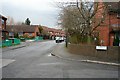
Farndale Drive
An estate of "starter homes" built, I would guess, between 1975 and 1985.
Image: © David Lally
Taken: 16 Feb 2010
0.04 miles
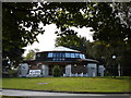
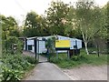
2
Site of the former Gondola public house
Later Spices restaurant.
Image: © Andrew Abbott
Taken: 24 Apr 2020
0.06 miles
4
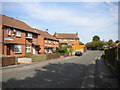
Farndale Drive, Wollaton
A residential street off the northern end of Wollaton Vale.
Image: © Richard Vince
Taken: 15 Sep 2012
0.08 miles
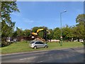
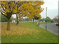
5
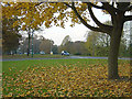
Autumn leaves, Wollaton Vale
Pleasant autumn colours in suburban Nottingham. Wollaton Vale is one of the main peripheral through connections on the west side of the City.
Image: © Alan Murray-Rust
Taken: 4 Nov 2007
0.08 miles
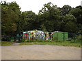
7
Rise, Balloon Woods
A learning zone for disadvantaged young people.
Image: © Andrew Abbott
Taken: 24 Apr 2020
0.09 miles
8
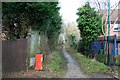
Path to Balloon Woods
The path here is crossed by a twitchell between Teesbrook Drive and Sharnford Way.
The border between the City of Nottingham and The Borough of Broxtowe runs along this path.
Image: © David Lally
Taken: 16 Feb 2010
0.09 miles
9
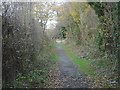
Moor Lane, Balloon Woods
This is clearly an old established right of way which runs from Bramcote right across Trowell Moor and on towards Cossall, Awsworth and Kimberley
Image: © Alan Murray-Rust
Taken: 25 Nov 2007
0.10 miles
10
Autumn leaves at Rosedale Drive
Rosedale Drive, the road on the right was built to serve the ill-starred Balloon Woods flats complex of the 1960s. Because of social problems these were demolished in the early 80s and replaced with lower density housing.
Image: © Alan Murray-Rust
Taken: 4 Nov 2007
0.10 miles