
IMAGES TAKEN NEAR TO
Mount Heights, NOTTINGHAM, NG7 7HA
Introduction
This page details the photographs taken nearby to Mount Heights, NG7 7HA by members of the Geograph project.
The Geograph project started in 2005 with the aim of publishing, organising and preserving representative images for every square kilometre of Great Britain, Ireland and the Isle of Man.

There are currently over 7.5m images from over14,400 individuals and you can help contribute to the project by visiting https://www.geograph.org.uk
Image Map
Images are licensed for reuse under creativecommons.org/licenses/by-sa/2.0
Notes
- Clicking on the map will re-center to the selected point.
- The higher the marker number, the further away the image location is from the centre of the postcode.
Image Listing (141 Images Found)
Images are licensed for reuse under creativecommons.org/licenses/by-sa/2.0
Image
Details
Distance
1
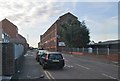
Mount Street
The former Mount Street Mill is now Middlesex International College, which specialises in commercial diploma courses. The building is on the crest of the ridge which separates Sherwood Rise, Forest Fields and Hyson Green (ahead) from New Basford.
Image: © John Sutton
Taken: 27 Sep 2013
0.02 miles
2
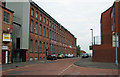
Palmerston House (Mount Street Mill)
A former hosiery factory converted to offices. The building is advertised as suitable for educational as well as commercial use.
Image: © John Sutton
Taken: 27 Apr 2011
0.03 miles
3
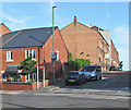
Mount Street
A view across Gladstone Street from the corner of Stanley Road. Mount Street Mill (in Image) is at the crest of the hill which marks the frontier of Forest Fields and New Basford.
Image: © John Sutton
Taken: 23 Aug 2013
0.04 miles
4
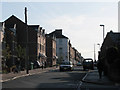
Gladstone Street
Looking east, showing some newer terraced houses.
Image: © John Sutton
Taken: 24 Sep 2009
0.07 miles
5
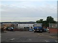
South-west from Duke Street
A view over some of Nottingham's western suburbs from the ridge which marks the border between Forest Fields and New Basford. Wollaton Hall is on the skyline to the left, the hills beyond Bilborough and Strelley in the centre.
Image: © John Sutton
Taken: 27 Sep 2013
0.07 miles
6
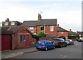
On Gladstone Street
Libris Bookbinders on the left, the corner of Bradgate Road just beyond the cars.
Image: © John Sutton
Taken: 27 Sep 2013
0.07 miles
7
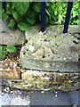
Benchmark on wall of Forest Fields Community Centre
Ordnance Survey rivet benchmark described on the Bench Mark Database at http://www.bench-marks.org.uk/bm35173.
Image: © Roger Templeman
Taken: 10 Aug 2010
0.07 miles
8
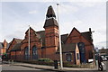
Forest Fields Community Centre, Gladstone Street
There is an OS benchmark Image on the low wall coping stone behind the left hand post of the Stanley Road name sign
Image: © Roger Templeman
Taken: 31 Mar 2013
0.08 miles
9
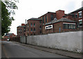
Guy Birkin Place Business Park, Beech Avenue
Once a lace factory owned by the Birkin family, whose wealth (and acquisition of the land) led to the development of Forest Fields as a genteel suburb, this is now let as offices, with permission for educational use.
Image: © John Sutton
Taken: 27 Apr 2011
0.08 miles
10

Newer houses on Gladstone Street
Seen from the corner of Ewart Road. (Sadly there is no William Road nearby, to complete the Victorian Prime Minister's name.)
Image: © John Sutton
Taken: 31 Jul 2025
0.08 miles