
IMAGES TAKEN NEAR TO
Nottingham Road, NOTTINGHAM, NG7 7AH
Introduction
This page details the photographs taken nearby to Nottingham Road, NG7 7AH by members of the Geograph project.
The Geograph project started in 2005 with the aim of publishing, organising and preserving representative images for every square kilometre of Great Britain, Ireland and the Isle of Man.

There are currently over 7.5m images from over14,400 individuals and you can help contribute to the project by visiting https://www.geograph.org.uk
Image Map
Images are licensed for reuse under creativecommons.org/licenses/by-sa/2.0
Notes
- Clicking on the map will re-center to the selected point.
- The higher the marker number, the further away the image location is from the centre of the postcode.
Image Listing (72 Images Found)
Images are licensed for reuse under creativecommons.org/licenses/by-sa/2.0
Image
Details
Distance
1
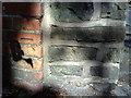
Benchmark on wall of Langtry Grove in shadow of tree
Ordnance Survey cut mark benchmark described on the Bench Mark Database at http://www.bench-marks.org.uk/bm35165.
Image: © Roger Templeman
Taken: 10 Aug 2010
0.02 miles
2
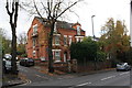
#77A Nottingham Road at Langtry Grove junction
There is an OS benchmark Image on the brick wall left of the entrance gatepost
Image: © Roger Templeman
Taken: 4 Nov 2017
0.02 miles
4
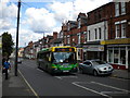
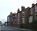
Bus climbing Nottingham Road, New Basford
The southern half of Nottingham Road is closely lined with housing, punctuated by a few shops. The variety in the architecture is noteworthy, considering that it all presumably dates from the inception of electric trams along this route. One of the trams' successors is heading for the city centre, working a 69 from Bulwell.
Image: © Richard Vince
Taken: 11 Jun 2011
0.05 miles
6
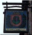
The Royal Oak, New Basford
On Nottingham Road.
Image: © JThomas
Taken: 27 Mar 2017
0.06 miles
7
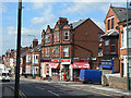
Spam Stores
Corner shop on Nottingham Road at central Avenue, possibly formerly a Co-op store.
Image: © Alan Murray-Rust
Taken: 27 Aug 2009
0.06 miles
8
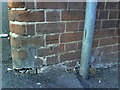
Benchmark on The Royal Oak PH, Nottingham Road
Ordnance Survey cut mark benchmark which is described on the Bench Mark Database at http://www.bench-marks.org.uk/bm35166.
Image: © Roger Templeman
Taken: 10 Aug 2010
0.06 miles
9
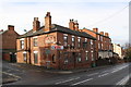
The Royal Oak, Nottingham Road at Sandon Street junction
There is an OS benchmark Image on the near corner, right hand face, of the pub
Image: © Roger Templeman
Taken: 4 Nov 2017
0.06 miles
10
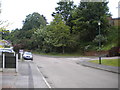
Turning area, Camelot Avenue
The turning facility at the south end of Camelot Avenue, New Basford. The road ends just beyond the further of the two parked cars.
Image: © Richard Vince
Taken: 9 Jun 2012
0.06 miles