IMAGES TAKEN NEAR TO
Gladstone Street, NOTTINGHAM, NG7 6HY
Introduction
This page details the photographs taken nearby to Gladstone Street, NG7 6HY by members of the Geograph project.
The Geograph project started in 2005 with the aim of publishing, organising and preserving representative images for every square kilometre of Great Britain, Ireland and the Isle of Man.

There are currently over 7.5m images from over14,400 individuals and you can help contribute to the project by visiting https://www.geograph.org.uk
Image Map
Images are licensed for reuse under creativecommons.org/licenses/by-sa/2.0
Notes
- Clicking on the map will re-center to the selected point.
- The higher the marker number, the further away the image location is from the centre of the postcode.
Image Listing (182 Images Found)
Images are licensed for reuse under creativecommons.org/licenses/by-sa/2.0
Image
Details
Distance
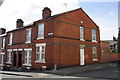
2
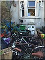
Bikes outside the SUMAC centre
The end point of the July Nottingham Critical Mass bike ride.
For info on the SUMAC centre see http://www.veggies.org.uk/sumac/welcome.html .
Image: © David Lally
Taken: 31 Jul 2015
0.03 miles
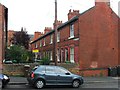
3
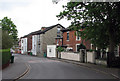
Older houses on Beech Avenue
Most of Forest Fields dates from the last years of the Victorian era and the early part of the twentieth century, but these villas date from earlier in the nineteenth century, probably dating from shortly after the Enclosure Act of 1845 which led to the rapid expansion of the city.
Image: © John Sutton
Taken: 27 Apr 2011
0.03 miles
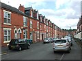
5
Leslie Road, Forest Fields
Looking south east from Alberta Terrace.
Image: © JThomas
Taken: 27 Mar 2017
0.04 miles
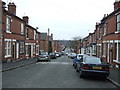
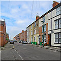
6
Junction of Gladstone Street and Leslie Road
The corner houses are #232 Gladstone Street and #141 Leslie Road.
Image: © Roger Templeman
Taken: 31 Mar 2013
0.05 miles
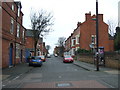
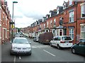
9
Old and new terraces on Gladstone Street
Diligence Villas, the terrace on the right, is dated 1897. Beyond, a twenty-first-century version is going up. Leslie Road, on the left, leads down the hill to Gregory Boulevard and The Forest.
Image: © John Sutton
Taken: 19 May 2023
0.05 miles
10
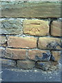
Benchmark on Gladstone Street wall
Ordnance Survey cut mark benchmark described on the Bench Mark Database at http://www.bench-marks.org.uk/bm35196
Image: © Roger Templeman
Taken: 10 Aug 2010
0.05 miles