1
Stanley Road: former schools
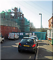
The building in the left foreground, on the corner of Gladstone Street and Stanley Road, now a community centre, was once Stanley Road Primary School. The grander building beyond was originally High Pavement Boys' Grammar School and later Forest Fields Grammar School. Towards the end of my time as a Forestian (1959-66), the primary school building became part of FFGS, and the base for the arts sixth. The asphalt playground between the two buildings was at that time the site of viciously-contested lunchtime football matches.
Image: © John Sutton
Taken: 27 Apr 2011
0.01 miles
2
Forest Fields Community Centre, Gladstone Street
There is an OS benchmark
Image on the low wall coping stone behind the left hand post of the Stanley Road name sign
Image: © Roger Templeman
Taken: 31 Mar 2013
0.01 miles
3
Recycling my old school
High Pavement and then Forest Fields Grammar Schools, this building has been put to various uses since FFGS moved to Carlton in the 1970s. It is now being refurbished and converted for use by Forest Fields Primary School. See
Image] and
Image] for earlier views of Stanley Road.
Image: © John Sutton
Taken: 1 May 2013
0.01 miles
4
Benchmark on wall of Forest Fields Community Centre
Ordnance Survey rivet benchmark described on the Bench Mark Database at http://www.bench-marks.org.uk/bm35173.
Image: © Roger Templeman
Taken: 10 Aug 2010
0.01 miles
5
Nottingham, NG7 (Forest Fields)
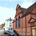
The inscription above this entrance reads "Stanley Road Council School", although the building is now occupied by the Forest Fields Community Centre that borders a stretch of Gladstone Street and also occupies the top end of Sturton Street.
Image: © David Hallam-Jones
Taken: 24 Jun 2012
0.02 miles
6
Nottingham, NG7 (Forest Fields)
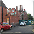
Until 1956 this was High Pavement Boys' Grammar School. After this, High Pavement School decamped to a new building in Bestwood and this building became the co-educational Forest Fields Grammar School. It is now a training location used by the Nottingham Fire and Rescue Service. Here there is evidence of the need for additional space and a "Portakabin" was added after Stanley Road had been closed to traffic, although another section of this road continues beyond this enclosure.
Image: © David Hallam-Jones
Taken: 24 Jun 2012
0.02 miles
7
Forest Fields: renewing a school
Nottingham has had good value from this school, built in 1895, successively High Pavement and Forest Fields Grammar Schools and soon to be the home of Forest Fields Primary School. The scaffolding has come down since I was here in May, and most of the restored windows are in place - see
Image], which has links to earlier pictures.
Image: © John Sutton
Taken: 23 Aug 2013
0.02 miles
8
On Gladstone Street
Libris Bookbinders on the left, the corner of Bradgate Road just beyond the cars.
Image: © John Sutton
Taken: 27 Sep 2013
0.03 miles
9
Nottingham, NG7 (Forest)
The Stanley Road entrance of what was, until 1956, was the High Pavement Boys' Grammar School. After this High Pavement School decamped to a new building in Bestwood and this building became the co-educational Forest Fields Grammar School. It is now a training location used by the Nottingham Fire and Rescue Service.
Image: © David Hallam-Jones
Taken: 24 Jun 2012
0.03 miles
10
Stanley Road: Forest Fields Primary School playground
A view up what was originally a cobbled street, with Mount Street Mill on the skyline. Forest Fields Primary is the fourth school – after High Pavement and Forest Fields Grammar Schools and Claremont Secondary – to occupy the Grade II listed building on Stanley Road, which was refurbished at a cost of £6.5m in 2013-14.
This picture was taken during a tour of the building by Old Paviors (and two Old Forestians), some of whose memories of the school dated back to the late 1930s.
Image] shows the building in 2003.
Image] and
Image] show building work in progress in 2013.
For the Grade II listing, see http://www.britishlistedbuildings.co.uk/en-458870-clarendon-college-berridge-centre- .
Image: © John Sutton
Taken: 9 Feb 2015
0.03 miles


