
IMAGES TAKEN NEAR TO
Thurman Street, NOTTINGHAM, NG7 5AU
Introduction
This page details the photographs taken nearby to Thurman Street, NG7 5AU by members of the Geograph project.
The Geograph project started in 2005 with the aim of publishing, organising and preserving representative images for every square kilometre of Great Britain, Ireland and the Isle of Man.

There are currently over 7.5m images from over14,400 individuals and you can help contribute to the project by visiting https://www.geograph.org.uk
Image Map
Images are licensed for reuse under creativecommons.org/licenses/by-sa/2.0
Notes
- Clicking on the map will re-center to the selected point.
- The higher the marker number, the further away the image location is from the centre of the postcode.
Image Listing (197 Images Found)
Images are licensed for reuse under creativecommons.org/licenses/by-sa/2.0
Image
Details
Distance
1
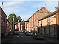
Thurman Street
Part of the rapid extension of the city to the west in the last decades of the 19th century. The newer houses replace terraces cleared in the 1970s.
Image: © John Sutton
Taken: 13 Sep 2012
0.03 miles
2
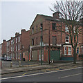
A derelict shop on Alfreton Road
I believe the derelict end-of-terrace shop on the corner of Alfreton Road and Collison Street was, in my post-war childhood in these parts, a dry cleaner’s owned by Nottingham Panthers’ Canadian ice hockey star Chick Zamick (https://en.wikipedia.org/wiki/Chick_Zamick ).
Image: © John Sutton
Taken: 23 Jan 2017
0.05 miles
3
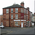
Birkin Avenue: once a corner shop
A typical late Victorian three-storey block, with replacement windows and roof tiles, at the corner of Oldknow Street. A faded sign above the door of what was a corner shop or beer-off advertises Hooley's Noted - something or other (the rest is overpainted).
Image: © John Sutton
Taken: 23 Jan 2017
0.06 miles
5
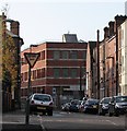
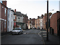
A November morning in Palin Street
A foreshortened view of the stretch of Palin Street between Birkin Avenue and Alfreton Road. Closing off the view, on the corner of Alfreton Road and Beckenham Road, is what was originally one of the more recent of the Players tobacco factories in Radford, now an office block known as New Brook House.
Image: © John Sutton
Taken: 20 Nov 2009
0.06 miles
6
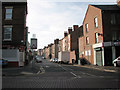
Birkin Avenue
Looking south from Gregory Boulevard.
Image: © John Sutton
Taken: 25 Sep 2009
0.06 miles
7
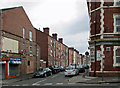
Radford: the corner of Alfreton Road and Palin Street
Houses, shops and an hotel built as Nottingham mushroomed in the last quarter of the nineteenth century. For another view of this corner, see Alan Murray-Rust's Image] (2008).
Image: © John Sutton
Taken: 8 Jul 2015
0.07 miles
8
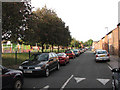
Bridlington Street
Formerly a street of Victorian terraced houses.
Image: © John Sutton
Taken: 25 Sep 2009
0.07 miles
9
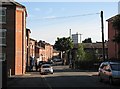
Player Street
Looking across Alfreton Road and down Thurman Street towards Hyson Green. The area is a mixture of late Victorian terraces and more recent housing.
Image: © John Sutton
Taken: 13 Sep 2012
0.07 miles
10
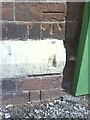
Benchmark on The Clarence Hotel
Ordnance Survey cut mark benchmark described on the Bench Mark Database at http://www.bench-marks.org.uk/bm35203.
Image: © Roger Templeman
Taken: 10 Aug 2010
0.07 miles