1
Court Street, Hyson Green
The back of the Mary Potter Centre.
Image: © John Sutton
Taken: 25 Sep 2009
0.06 miles
2
Hyson Green: on Palin Street
Looking towards Radford Road from near the corner of Hubert Street. Claypole Road rises on the other side of Radford Road.
Image: © John Sutton
Taken: 20 Nov 2009
0.06 miles
3
Hyson Green: Acourt Street
Image: © John Sutton
Taken: 20 Nov 2009
0.06 miles
4
Palin Street
Image: © John Sutton
Taken: 20 Nov 2009
0.07 miles
5
Radford Road, Hyson Green
Image: © John Sutton
Taken: 20 Nov 2009
0.07 miles
6
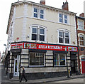
Hyson Green - the former Staddons store
Older people will remember the Staddons furnishing store and its huge clock on the Radford Road side, above the main door. The white panel above the windows on the Caulton Street facade once carried the Staddon name, in large, flourishing letters.
Image: © John Sutton
Taken: 20 Nov 2009
0.07 miles
7
Hyson Green: Acourt Street
The building on the right, now a mosque, was originally, according to Robert Mellors' "Old Nottingham suburbs: then and now" (1914), a handicraft centre, one of the many council schools - including Bentinck Road, Berridge Road, Scotholme and Forster Street - built in Radford following the Forster Education Act of 1870.
Image: © John Sutton
Taken: 20 Nov 2009
0.07 miles
8
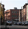
A November morning in Palin Street
A foreshortened view of the stretch of Palin Street between Birkin Avenue and Alfreton Road. Closing off the view, on the corner of Alfreton Road and Beckenham Road, is what was originally one of the more recent of the Players tobacco factories in Radford, now an office block known as New Brook House.
Image: © John Sutton
Taken: 20 Nov 2009
0.08 miles
9
Radford Road, Hyson Green
Image: © John Sutton
Taken: 25 Sep 2009
0.08 miles
10
Former pub, Radford Road
Image: © SK53
Taken: 7 Apr 2013
0.08 miles


