
IMAGES TAKEN NEAR TO
Waverley Street, NOTTINGHAM, NG7 4DX
Introduction
This page details the photographs taken nearby to Waverley Street, NG7 4DX by members of the Geograph project.
The Geograph project started in 2005 with the aim of publishing, organising and preserving representative images for every square kilometre of Great Britain, Ireland and the Isle of Man.

There are currently over 7.5m images from over14,400 individuals and you can help contribute to the project by visiting https://www.geograph.org.uk
Image Map
Images are licensed for reuse under creativecommons.org/licenses/by-sa/2.0
Notes
- Clicking on the map will re-center to the selected point.
- The higher the marker number, the further away the image location is from the centre of the postcode.
Image Listing (275 Images Found)
Images are licensed for reuse under creativecommons.org/licenses/by-sa/2.0
Image
Details
Distance
1
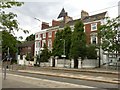
Mount Vernon Terrace, Waverley Street, Nottingham
A terrace of 4 town houses, built c.1840, the tower added c.1865 by T C Hine, the Nottingham architect, supposedly added to give a view of horse races on The Forest. Listed Grade II, the Listing referring to garden railings, most of which have been replaced by the less attractive concrete block screens.
Image: © Alan Murray-Rust
Taken: 12 Aug 2019
0.01 miles
2
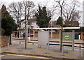
Waverley Street, Nottingham
Since Nottingham Express Transit trams started running along Waverley Street in March 2004 this end of Gedling Grove has been a cul-de-sac. This tram stop is known as High School, since this fee-paying establishment is situated on the opposite side of the street, to the right. Pedestrians turning left here can reach The Forest, a well-known recreation area, within minutes.
Image: © David Hallam-Jones
Taken: 13 Feb 2016
0.01 miles
3
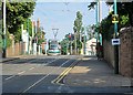
Nottingham High School tram stop
The stop is at the top of the sandstone ridge, so northbound trams face a stiff climb up Waverley Street and city-bound ones a slog up from The Forest.
Image: © John Sutton
Taken: 23 Aug 2013
0.01 miles
4
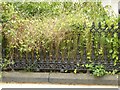
Mount Vernon Terrace, Waverley Street, Nottingham ? detail
The last remaining section of original railings mentioned in the Listing of the terrace. See http://www.geograph.org.uk/photo/6238420 for location.
Image: © Alan Murray-Rust
Taken: 12 Aug 2019
0.01 miles
5
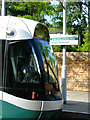
High School Tram Stop
A tram heading into the city centre pauses at the High School stop at the top of Waverley Street.
Image: © Stephen McKay
Taken: 3 Jul 2008
0.02 miles
6
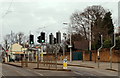
Waverley Mount, Nottingham
A view of the "High School" tram stop. The school site is behind the stone wall. In the distance is a 'Sainsbury's Local' supermarket that now occupies the former Vernon Arms public house. From 1650 this refreshment site operated as a coffee house and boasted a bowling green. What was then a narrow lane leading (downhill) to the city centre was called Bowling Alley Lane but its name was changed to Waverley Street in 1830. At about the same time - for some unknown reason - this former refreshment site became known as The Vernon Arms.
Image: © David Hallam-Jones
Taken: 13 Feb 2016
0.02 miles
7
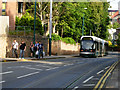
Waverley Street, Nottingham
A tram heads down Waverley Street towards the city centre.
Image: © Stephen McKay
Taken: 3 Jul 2008
0.02 miles
8
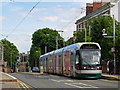
Waverley Street, Nottingham
A tram reaches the top of the steepish climb up Waverley Street to call at the High School stop. Its final destination is Hucknall.
Image: © Stephen McKay
Taken: 3 Jul 2008
0.03 miles
9
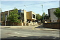
Entrance to Nottingham High School from Waverley Street
Ordnance Survey records indicate that a benchmark was levelled at 76.756m above Newlyn Datum in 1986 on the roadside wall to the left of the school entrance. The wall appears to have been rebuilt.
Image: © phil Richards
Taken: 14 Sep 2019
0.03 miles
10
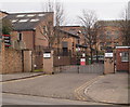
Waverley Mount, Nottingham
The "Visitors' Entrance" on the west side of the Nottingham High School site, off Waverley Mount. This private school has existed here since 1865. Nottingham Express Transit trams travel past the school, with a stop known as "the High School stop" situated 10-15 metres away on the left.
Image: © David Hallam-Jones
Taken: 13 Feb 2016
0.04 miles