IMAGES TAKEN NEAR TO
Bentinck Road, NOTTINGHAM, NG7 4AF
Introduction
This page details the photographs taken nearby to Bentinck Road, NG7 4AF by members of the Geograph project.
The Geograph project started in 2005 with the aim of publishing, organising and preserving representative images for every square kilometre of Great Britain, Ireland and the Isle of Man.

There are currently over 7.5m images from over14,400 individuals and you can help contribute to the project by visiting https://www.geograph.org.uk
Image Map
Images are licensed for reuse under creativecommons.org/licenses/by-sa/2.0
Notes
- Clicking on the map will re-center to the selected point.
- The higher the marker number, the further away the image location is from the centre of the postcode.
Image Listing (234 Images Found)
Images are licensed for reuse under creativecommons.org/licenses/by-sa/2.0
Image
Details
Distance
1
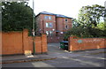
Brick walls at entrance to 36 Bentinck Road
The Ordnance Survey cut a benchmark on the wall in 1962 and levelled it at 53.499m above Newlyn Datum: see www.bench-marks.org.uk/bm111705 for details. Apparently the walls have been rebuilt.
Image: © Luke Shaw
Taken: 14 Sep 2019
0.01 miles
2
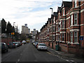
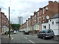
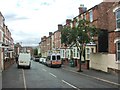
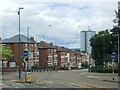
Bentinck Road
The bus is waiting at the traffic lights at the top of Radford Road. The tower blocks in the distance are on Hartley Road.
Image: © John Sutton
Taken: 20 Nov 2009
0.03 miles
4
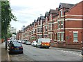
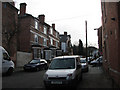
Bentinck Road
Looking toward Radford from Noel Street
Image: © David Lally
Taken: 5 Oct 2010
0.04 miles
8
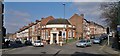
Former National Provincial Bank at corner of Radford Road and Bentinck Road
It is suggested that this may have been most recently an Indian bank, but originally it seems to have been opened by the National Provincial Bank after 1918, and became a National Westminster Bank branch after Westminster and National Provincial merged about 1967.
Image: © Chris Morgan
Taken: 10 Mar 2014
0.06 miles
10
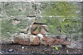
Benchmark on the wall of Mount Hooton Road
Ordnance Survey cut mark benchmark described on the Bench Mark Database at http://www.bench-marks.org.uk/bm42611
Image: © Roger Templeman
Taken: 9 Apr 2012
0.06 miles