
IMAGES TAKEN NEAR TO
Hartley Road, NOTTINGHAM, NG7 3AH
Introduction
This page details the photographs taken nearby to Hartley Road, NG7 3AH by members of the Geograph project.
The Geograph project started in 2005 with the aim of publishing, organising and preserving representative images for every square kilometre of Great Britain, Ireland and the Isle of Man.

There are currently over 7.5m images from over14,400 individuals and you can help contribute to the project by visiting https://www.geograph.org.uk
Image Map
Images are licensed for reuse under creativecommons.org/licenses/by-sa/2.0
Notes
- Clicking on the map will re-center to the selected point.
- The higher the marker number, the further away the image location is from the centre of the postcode.
Image Listing (171 Images Found)
Images are licensed for reuse under creativecommons.org/licenses/by-sa/2.0
Image
Details
Distance
1
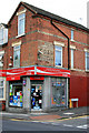
Radford News Centre
On the corner of Hartley Road and Crewe Close. With a fading painted advertisement for a coal merchant.
Image: © David Lally
Taken: 5 Oct 2010
0.05 miles
2
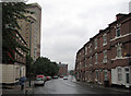
Hartley Road, Radford: old and new
The Colonel Burnaby public house is the only Victorian survivor on the south side of Hartley Road. Radford Boulevard and Boulevard Works are in the distance, before Hartley Road dips down past St Peter's Church into the Leen valley.
Image: © John Sutton
Taken: 26 Aug 2010
0.06 miles
3
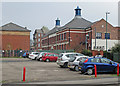
Castle Cavendish Works
According to its website, Castle Cavendish “aims to support the growth and development of the community and voluntary sector and make a real impact to the quality of life for local communities.” Castle Cavendish Works is “a managed office-space facility that provides serviced offices, along with conference, training and meeting space [and] a range of commercial office space”. The building dates from 1898.
The view is from Hartley Road. In the background, on the other side of Norton Street, are some of the remains of the former Player's cigarette factory, destroyed by fire on 30 March 2015.
Image: © John Sutton
Taken: 20 Apr 2015
0.06 miles
4
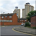
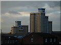
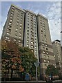
Radford contrast
These flats and houses, seen from Norton Street, replaced Victorian terraces late in the twentieth century.
Image: © John Sutton
Taken: 25 Aug 2021
0.06 miles
7

The Colonel Burnaby, Radford
Now looking rather out of place being dwarfed by blocks of high rise flats, the Colonel Burnaby is in a similar situation to many inner city pubs that survived slum clearance projects. It is located on Hartley Road at its junction with Denison Street (left).
Image: © Richard Vince
Taken: 1 Feb 2013
0.08 miles
8
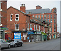
Hartley Road and the former Boulevard Works
The view at the Radford Boulevard end of Hartley Road is dominated by the five storeys of the former Meridian knitwear factory, now student flats (see Image] and Image]).
Image: © John Sutton
Taken: 20 Apr 2015
0.08 miles
9

Radford: up Hartley Road
Looking towards Alfreton Road on a bright September morning. Three-storey houses like these were built in huge numbers in Nottingham in the last quarter of the nineteenth century.
Image: © John Sutton
Taken: 12 Sep 2019
0.09 miles
10
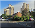
Radford: high-rise flats
Looking north along Norton Street on a September morning.
Image: © John Sutton
Taken: 12 Sep 2019
0.09 miles