
IMAGES TAKEN NEAR TO
Johnson Road, NOTTINGHAM, NG7 2BX
Introduction
This page details the photographs taken nearby to Johnson Road, NG7 2BX by members of the Geograph project.
The Geograph project started in 2005 with the aim of publishing, organising and preserving representative images for every square kilometre of Great Britain, Ireland and the Isle of Man.

There are currently over 7.5m images from over14,400 individuals and you can help contribute to the project by visiting https://www.geograph.org.uk
Image Map
Images are licensed for reuse under creativecommons.org/licenses/by-sa/2.0
Notes
- Clicking on the map will re-center to the selected point.
- The higher the marker number, the further away the image location is from the centre of the postcode.
Image Listing (140 Images Found)
Images are licensed for reuse under creativecommons.org/licenses/by-sa/2.0
Image
Details
Distance
1
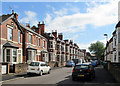
Lenton: up Dunlop Avenue
Villas typical of the Nottingham suburbs which were built in the last years of the nineteenth century and the first of the twentieth.
Image: © John Sutton
Taken: 8 Jul 2015
0.03 miles
2
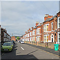
Lenton: down Dunlop Avenue
Villas typical of the Nottingham suburbs which were built in the last years of the nineteenth century and the first of the twentieth.
Image: © John Sutton
Taken: 8 Jul 2015
0.03 miles
3
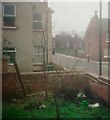
Johnson Road, 1992
Viewed from the rear of number 39.
Image: © Mark Anderson
Taken: Unknown
0.04 miles
4
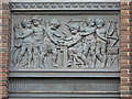
Making bicycles (2)
Decorative bronze panel on the former Raleigh offices. There are three different designs.Image, Image
Image: © Alan Murray-Rust
Taken: 7 Nov 2008
0.04 miles
5
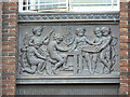
Making bicycles (3)
Decorative bronze panel on the former Raleigh offices. There are three different designs.Image, Image
Image: © Alan Murray-Rust
Taken: 7 Nov 2008
0.04 miles
7
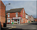
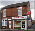
Lenton: the corner of Cycle Road
Victorian houses which once backed on to the Raleigh Cycle Factory.
Image: © John Sutton
Taken: 8 Jul 2015
0.05 miles
8
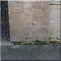
Bench mark, former Sandfield School
See http://www.geograph.org.uk/photo/3853863 for location.
Image: © Alan Murray-Rust
Taken: 16 Feb 2014
0.07 miles
9
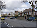
Former Sandfield School, Lenton Boulevard
More recently the Sandfield Centre, the site is earmarked for housing development.
There is a bench mark http://www.geograph.org.uk/photo/3853865 on the right hand side of the gateway.
Image: © Alan Murray-Rust
Taken: 16 Feb 2014
0.07 miles
10
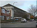
Former Raleigh offices
Now mainly used for small businesses, there is also a Caribbean centre at this end of the building.
Image: © Alan Murray-Rust
Taken: 7 Nov 2008
0.08 miles