
IMAGES TAKEN NEAR TO
Clarges Street, NOTTINGHAM, NG6 9JG
Introduction
This page details the photographs taken nearby to Clarges Street, NG6 9JG by members of the Geograph project.
The Geograph project started in 2005 with the aim of publishing, organising and preserving representative images for every square kilometre of Great Britain, Ireland and the Isle of Man.

There are currently over 7.5m images from over14,400 individuals and you can help contribute to the project by visiting https://www.geograph.org.uk
Image Map
Images are licensed for reuse under creativecommons.org/licenses/by-sa/2.0
Notes
- Clicking on the map will re-center to the selected point.
- The higher the marker number, the further away the image location is from the centre of the postcode.
Image Listing (25 Images Found)
Images are licensed for reuse under creativecommons.org/licenses/by-sa/2.0
Image
Details
Distance
1
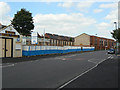
Bulwell Tram Depot
The old back wall of the tram depot can be seen over the blue and white fencing. Built for the electric trams in 1901, it was subsequently used by trolleybuses and finally motorbuses before being sold by Nottingham City Transport in around 2002. The site is now being developed for housing.
Image: © Alan Murray-Rust
Taken: 27 Aug 2009
0.04 miles
2
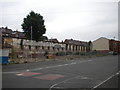
Site of Bulwell bus garage
Located on Piccadilly, just off Highbury Road about half a mile south east of Bulwell town centre, the bus garage here was previously a trolleybus depot, and before that a tram depot. If memory serves, it was closed by Nottingham City Transport in 2000; however, redevelopment of the site has been fairly slow. Since the housing visible on the extreme right was constructed, nothing much seems to have happened here.
Image: © Richard Vince
Taken: 11 Jun 2013
0.05 miles
3
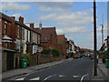
Broomhill Road
Development is this area, Highbury Vale, was stimulated by the coming of the electric tram to Bulwell.
Image: © Alan Murray-Rust
Taken: 27 Aug 2009
0.05 miles
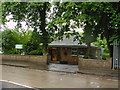
5
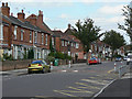
Piccadilly, Bulwell
Note the change in housing style from late Victorian terrace to inter-war semi-detached as you move further from the main Highbury Road (behind the camera).
Image: © Alan Murray-Rust
Taken: 27 Aug 2009
0.10 miles
7
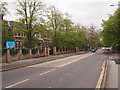
Nottingham - NG6 (Highbury Vale)
A view of the Henry Mellish School on Highbury Road (B682) looking in the direction of Old Basford and the city centre. This former Grammar School changed first to become a Comprehensive School and then to became part of Bulwell Academy (on a short term basis) prior to its closure in June 2009.
Image: © David Hallam-Jones
Taken: 4 May 2012
0.15 miles
9
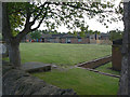
Highbury Hospital
The old buildings - it was originally the Basford Workhouse infirmary - have been entirely replaced by modern buildings on this part of the site.
Image: © Alan Murray-Rust
Taken: 27 Aug 2009
0.17 miles
10
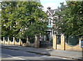
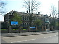
Bulwell Academy
This was previously the Henry Mellish School.
Image: © Alan Murray-Rust
Taken: 27 Aug 2009
0.18 miles