
IMAGES TAKEN NEAR TO
Hazelhurst Gardens, NOTTINGHAM, NG6 8HB
Introduction
This page details the photographs taken nearby to Hazelhurst Gardens, NG6 8HB by members of the Geograph project.
The Geograph project started in 2005 with the aim of publishing, organising and preserving representative images for every square kilometre of Great Britain, Ireland and the Isle of Man.

There are currently over 7.5m images from over14,400 individuals and you can help contribute to the project by visiting https://www.geograph.org.uk
Image Map
Images are licensed for reuse under creativecommons.org/licenses/by-sa/2.0
Notes
- Clicking on the map will re-center to the selected point.
- The higher the marker number, the further away the image location is from the centre of the postcode.
Image Listing (49 Images Found)
Images are licensed for reuse under creativecommons.org/licenses/by-sa/2.0
Image
Details
Distance
1
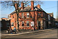
Framesmiths Arms
Public House near Bulwell shopping centre
Image: © Graham Hogg
Taken: 10 Mar 2014
0.10 miles
2
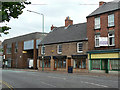
Middleton House, Main Street
Possibly the oldest surviving building in the centre of Bulwell, built in the distinctive local sandstone. Now home to a branch of one of Nottingham's major funeral director's, with associated stonemason.
Image: © Alan Murray-Rust
Taken: 27 Aug 2009
0.11 miles
3
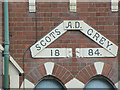
The old Scots Grey, detail
Close-up of the name; the pub Image is now boarded up.
Image: © Alan Murray-Rust
Taken: 27 Aug 2009
0.11 miles
4
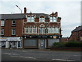
The old Scots Grey
The original name, with the date 1884, can be seen in the triangle above the first floor windows Image The makeover as The Venue has clearly not had lasting success.
Image: © Alan Murray-Rust
Taken: 27 Aug 2009
0.12 miles
5
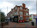
The former Scots Grey public house, Bulwell
Dates from 1884.
Image: © Jonathan Thacker
Taken: 3 Nov 2023
0.12 miles
6
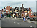
The Three Crowns
On Main Street, Bulwell. Another one which has succumbed to the downturn in the pub trade.
Image: © Alan Murray-Rust
Taken: 27 Aug 2009
0.12 miles
7
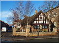
Nottingham, NG6 - Bulwell
Christ Church Cottage Homes are seen here at the junction of Main Street, the B682 road, and Minerva Street. According to a plaque mounted on the wall between the two windows, these almshouses were commissioned and paid for through an undated bequest left by someone referred to as F.Evans. The edge of a former "Methodist New Connexion Church" is visible on the right.
Image: © David Hallam-Jones
Taken: 15 Dec 2012
0.12 miles
8
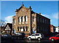
Nottingham, NG6 - Bulwell
This former "Methodist New Connexion" church (c.1882) on Main Street is currently being used by a Seventh-Day Adventist Church group. New Connexion Methodism was founded in England in 1797 following a schism with mainstream Methodism. Christ Church Cottages Homes on Minerva Road can be seen on the left. Ragdale Road on this side of the church is seen from Linby Street opposite.
Image: © David Hallam-Jones
Taken: 15 Dec 2012
0.12 miles
9
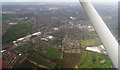
Bulwell: aerial 2014
Barker's Wood bottom centre, with Camberley Road running left-right above it.
Image: © Chris
Taken: 9 Apr 2014
0.13 miles
10
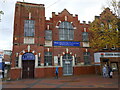
Mount Zion 7th Day Church of God, Bulwell
A fromer Salvation Army Citadel dates 1908.
Image: © Jonathan Thacker
Taken: 3 Nov 2023
0.13 miles