IMAGES TAKEN NEAR TO
Hucknall Lane, NOTTINGHAM, NG6 8AJ
Introduction
This page details the photographs taken nearby to Hucknall Lane, NG6 8AJ by members of the Geograph project.
The Geograph project started in 2005 with the aim of publishing, organising and preserving representative images for every square kilometre of Great Britain, Ireland and the Isle of Man.

There are currently over 7.5m images from over14,400 individuals and you can help contribute to the project by visiting https://www.geograph.org.uk
Image Map
Images are licensed for reuse under creativecommons.org/licenses/by-sa/2.0
Notes
- Clicking on the map will re-center to the selected point.
- The higher the marker number, the further away the image location is from the centre of the postcode.
Image Listing (49 Images Found)
Images are licensed for reuse under creativecommons.org/licenses/by-sa/2.0
Image
Details
Distance
1
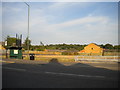
Site of the Apollo, Bulwell
The dilapidated pub sign (behind the bus shelter) and the name of the bus stop when this picture was taken are all that indicate that there was once a pub here. Although it had been closed for a few years, the Apollo was still a landmark in northern Bulwell, so I was surprised to find it had gone when I passed through.
Image: © Richard Vince
Taken: 15 Sep 2012
0.06 miles
2
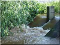
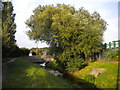
River Leen - Salmon ladder
This shows the River Leen in spate, subsequent to freak rainfall levels to the North of the County, particularly around Rotherham. This is a rarity, since the source, Mill Lakes, has a well-regulated channel which makes flooding unlikely.
Image: © Rodney Yates
Taken: 26 Jun 2007
0.06 miles
3
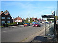
Hucknall Lane - Lawton Drive Bus Stop
Image: © Alan Heardman
Taken: 21 Oct 2007
0.07 miles
4
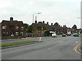
Hucknall Lane
The houses are part of a large inter-war council housing estate popularly known as Chinatown due to the amount of pottery found there.
Image: © Alan Murray-Rust
Taken: 27 Aug 2009
0.09 miles
5
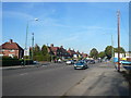
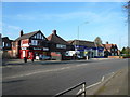
Bulwell - Grindon Crescent Junction with Hucknall Lane (A6002)
Image: © Alan Heardman
Taken: 21 Oct 2007
0.09 miles
6
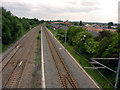
Moor Bridge
Recreating this 'First' for the square https://www.geograph.org.uk/photo/18593 .
Note the very substantial increase in tree growth.
The picture had to be taken more or less blind over the 2 metre high parapet.
Image: © Alan Murray-Rust
Taken: 19 Jul 2022
0.10 miles
7
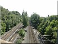
Moor Bridge
Railway and tram lines. Looking southwards.
Image: © Q
Taken: 14 Jun 2005
0.10 miles
8
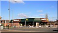
Bulwell's Golden Arches
Hamburger restaurant in the Nottingham suburbs.
Image: © Graham Hogg
Taken: 10 Mar 2014
0.10 miles
9
Bulwell - Layton Road Junction with Hucknall Lane (A6002)
Image: © Alan Heardman
Taken: 21 Oct 2007
0.11 miles
10
River Leen north of Bulwell
Much culverted and often hidden away as it flows south through Nottingham, in and around Bulwell the River Leen has a little more room.
Image: © Richard Vince
Taken: 15 Sep 2012
0.12 miles