
IMAGES TAKEN NEAR TO
Collins Close, NOTTINGHAM, NG6 7AH
Introduction
This page details the photographs taken nearby to Collins Close, NG6 7AH by members of the Geograph project.
The Geograph project started in 2005 with the aim of publishing, organising and preserving representative images for every square kilometre of Great Britain, Ireland and the Isle of Man.

There are currently over 7.5m images from over14,400 individuals and you can help contribute to the project by visiting https://www.geograph.org.uk
Image Map
Images are licensed for reuse under creativecommons.org/licenses/by-sa/2.0
Notes
- Clicking on the map will re-center to the selected point.
- The higher the marker number, the further away the image location is from the centre of the postcode.
Image Listing (21 Images Found)
Images are licensed for reuse under creativecommons.org/licenses/by-sa/2.0
Image
Details
Distance
1
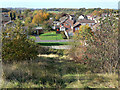
Hempshill Vale from Babbington tip
A 1970s housing development on the north-western edge of Nottingham
Image: © Alan Murray-Rust
Taken: 25 Oct 2009
0.10 miles
2
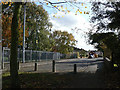
Armstrong Drive
The estate was developed from the southern end and for some time was not linked through towards Bulwell. At one point in the development, Armstrong Drive was stoppered at its northern end to prevent rat-running, and has remained so.
Image: © Alan Murray-Rust
Taken: 25 Oct 2009
0.12 miles
3
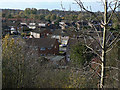
Hempshill Vale from Babbington tip
The curving road is Apollo Drive, the spine road of the estate. All the other roads are named after astronauts who took part in the Apollo space missions.
Image: © Alan Murray-Rust
Taken: 25 Oct 2009
0.12 miles
4
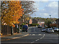
Apollo Drive
This is the spine road of the Hempshill Vale estate. All the other roads are named after astronauts who took part in the Apollo space missions.
Image: © Alan Murray-Rust
Taken: 25 Oct 2009
0.12 miles
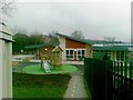
6
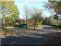
Hempshill Vale bus turn-round
The main bus service no longer turns here but continues through to Snape Wood.
Image: © Alan Murray-Rust
Taken: 25 Oct 2009
0.16 miles
7
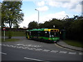
Bus in Hempshill Vale turning circle
A 69 to Nottingham city centre departs the bus turning circle in Hempshill Vale, Bulwell. Since 2004, buses serving this area have provided a circular service, meaning that nothing terminates here any more. However, buses that traverse the route in an anticlockwise direction use the turning circle essentially as a large bus stop lay by.
Image: © Richard Vince
Taken: 11 Jun 2011
0.17 miles
8
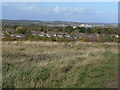
Tip top view of Hempshill Vale
The nearest housing is Hempshill Vale, a privately developed estate which was in many respects an extension to the council's Crabtree Estate. The distant industry is Hucknall airfield, part of which is occupied by Rolls Royce. In the distance the hills around Annesley which include the highest point in Nottinghamshire.
Image: © Alan Murray-Rust
Taken: 25 Oct 2009
0.21 miles
9
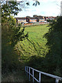
Footpath near Hempshill Hall
The new Low Wood Road is on an embankment so steps have had to be provided to provide access.
Image: © Alan Murray-Rust
Taken: 25 Oct 2009
0.21 miles
10
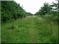
Footpath, Nuthall
This footpath, between the busy A610 route into Nottingham, and the Hempshill Vale housing estate, traverses what was once land belonging to the erstwhile Babbington Colliery. The footpath leads to the Phoenix Business Park, which is built on the old colliery site. Also on the site are a park and ride site and the tram terminus. See Image and Image
Image: © Lynne Kirton
Taken: 12 Jul 2008
0.21 miles