
IMAGES TAKEN NEAR TO
Pennant Road, NOTTINGHAM, NG6 0JB
Introduction
This page details the photographs taken nearby to Pennant Road, NG6 0JB by members of the Geograph project.
The Geograph project started in 2005 with the aim of publishing, organising and preserving representative images for every square kilometre of Great Britain, Ireland and the Isle of Man.

There are currently over 7.5m images from over14,400 individuals and you can help contribute to the project by visiting https://www.geograph.org.uk
Image Map
Images are licensed for reuse under creativecommons.org/licenses/by-sa/2.0
Notes
- Clicking on the map will re-center to the selected point.
- The higher the marker number, the further away the image location is from the centre of the postcode.
Image Listing (32 Images Found)
Images are licensed for reuse under creativecommons.org/licenses/by-sa/2.0
Image
Details
Distance
1
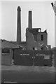
W E Saxby (Nottingham) Ltd, Bar Lane, Nottingham
Firm of bleachers and dyers. Closure announced 9-12-1983. Works in course of demolition. Two fine square (Staffordshire style) chimneys.
Image: © Chris Allen
Taken: 29 Sep 1985
0.04 miles
2
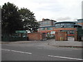
Ellis Guilford School
located on Bar Lane, Nottingham. It is also home to the Nottingham School of Music
Image: © Tom Courtney
Taken: 9 Sep 2005
0.06 miles
3
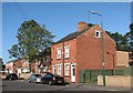
Basford Road: new and old
Lineker's Cottages date from 1879, the houses to the left from more recent years.
Image: © John Sutton
Taken: 13 Sep 2011
0.10 miles

6
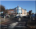
Junction of Melbourne Road with Nuthall road (A610)
With Sainsbury's at the corner. The busy A610 is the main route from north Nottingham to the M1.
Image: © Tim Heaton
Taken: 11 Nov 2012
0.17 miles
7
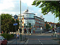
Cinema replacement
This site used to be occupied by the Commodore cinema. This survived for a long time as a conversion to a banqueting suite/conference centre, but has now been replaced by this retail/residential building.
Image: © Alan Murray-Rust
Taken: 4 Jun 2008
0.17 miles
8
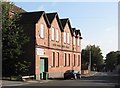
Basford Road: former Sunday School
The original name of this building, Baptist Centenary Sunday Schools, shows clearly in the low sunlight of a September morning. The building is now occupied by Sherwood Fabrics. It dates from 1899. For another view, see Image
Image: © John Sutton
Taken: 13 Sep 2011
0.18 miles
9
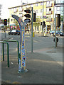
541 Dover Inverness 749
Sustrans millennium milepost at Melbourne Road, Basford, Nottingham. The reverse view, generally not posted in Geograph, can be seen in Image
Image: © Alan Murray-Rust
Taken: 4 Jun 2008
0.18 miles
10
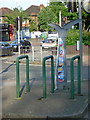
Sustrans milepost
This one stands in the central reservation of Melbourne Road at the junction of Nuthall Road. Provision has been made to park your cycle while looking at it!
Image: © Alan Murray-Rust
Taken: 4 Jun 2008
0.19 miles