
IMAGES TAKEN NEAR TO
Winrow Gardens, NOTTINGHAM, NG6 0GS
Introduction
This page details the photographs taken nearby to Winrow Gardens, NG6 0GS by members of the Geograph project.
The Geograph project started in 2005 with the aim of publishing, organising and preserving representative images for every square kilometre of Great Britain, Ireland and the Isle of Man.

There are currently over 7.5m images from over14,400 individuals and you can help contribute to the project by visiting https://www.geograph.org.uk
Image Map
Images are licensed for reuse under creativecommons.org/licenses/by-sa/2.0
Notes
- Clicking on the map will re-center to the selected point.
- The higher the marker number, the further away the image location is from the centre of the postcode.
Image Listing (35 Images Found)
Images are licensed for reuse under creativecommons.org/licenses/by-sa/2.0
Image
Details
Distance
1

Bagnall Road, Basford
Detached houses dating from the 1930s. The second from the left is faced in crazy-paving-effect terra-cotta, which had a brief vogue at that time. The other houses are red brick, with bargeboards.
Image: © John Sutton
Taken: 25 Aug 2010
0.07 miles
2

Stockhill Fire Station
Stockhill Lane Fire Station, Nottingham, part of Nottinghamshire Fire & Rescue Service, and recycling Point
Image: © Q
Taken: 15 Jun 2005
0.08 miles
3
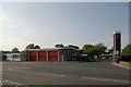
Stockhill Fire Station
Stockhill Fire Station, Stockhill Lane, Nottingham forms part of the Nottinghamshire Fire & Rescue Service. It gives a fuller view of the station than Image
Image: © Kevin Hale
Taken: 29 Apr 2007
0.09 miles
4

Stockhill Fire Station
Recreating this 'First' for the square https://www.geograph.org.uk/photo/18952
Image: © Alan Murray-Rust
Taken: 18 Jul 2023
0.09 miles
5
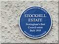
Plaque to Stockhill Estate
On face of 45 Stockhill Lane at junction with Broadwalk which was the first house to be built on the Estate. Put up to celebrate the centenary.
Image: © El Loco
Taken: 7 Apr 2021
0.11 miles
6

Recreation Ground off Stockhill Lane
Image: © Jonathan Thacker
Taken: 15 Nov 2023
0.12 miles
7

Slow response vehicle
Play equipment in this playground on Stockhill Lane is themed on the nearby fire station https://www.geograph.org.uk/photo/7545434.
Image: © Alan Murray-Rust
Taken: 18 Jul 2023
0.12 miles
8
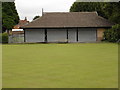
Bowls Pavilion, Stockhill Lane
Barred and shuttered on a grey weekday morning in August.
Image: © Oxymoron
Taken: 6 Aug 2008
0.16 miles
9
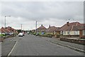
Basford: Greenwich Avenue
Bungalows and semis built during the building boom of the 1950s.
Image: © John Sutton
Taken: 7 Jul 2015
0.16 miles
10
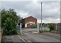
Basford: former school changing rooms
This was once Forest Fields Grammar School's Playing Field. It is now the clubhouse of Basford United Football Club, whose ground occupies part of the field. "Welcome to Greenwich Avenue", reads one of the signs on the gable end, but the green City Council sign at the gate calls it Mill Street Playing Field (though Mill Street is a little way away). We Forestians used the two names interchangeably.
The building was semi-derelict in 2008: see Image
Image: © John Sutton
Taken: 7 Jul 2015
0.16 miles