
IMAGES TAKEN NEAR TO
Finsbury Road, NOTTINGHAM, NG5 9QF
Introduction
This page details the photographs taken nearby to Finsbury Road, NG5 9QF by members of the Geograph project.
The Geograph project started in 2005 with the aim of publishing, organising and preserving representative images for every square kilometre of Great Britain, Ireland and the Isle of Man.

There are currently over 7.5m images from over14,400 individuals and you can help contribute to the project by visiting https://www.geograph.org.uk
Image Map
Images are licensed for reuse under creativecommons.org/licenses/by-sa/2.0
Notes
- Clicking on the map will re-center to the selected point.
- The higher the marker number, the further away the image location is from the centre of the postcode.
Image Listing (20 Images Found)
Images are licensed for reuse under creativecommons.org/licenses/by-sa/2.0
Image
Details
Distance
1
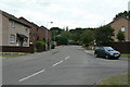
Finsbury Road
Part of the final stage of development of Top Valley. Originally planned as council housing, it was finally developed as private housing, under the name Warren Hill.
Off Bewcastle Road.
Image: © Alan Murray-Rust
Taken: 20 Jul 2010
0.04 miles
2
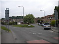
Former bus turning circle, Warren Hill
This turning circle, built into the junction of Finsbury Road with Bewcastle Road (foreground), did not have a particularly long life as a bus terminus: for most of its history, this area of housing has been served by buses either by way of a one way loop, or on their way from one place to another. Nowadays its primary use is for car parking.
Image: © Richard Vince
Taken: 11 Jun 2013
0.05 miles
3
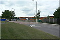
Big Wood School
Comprehensive Secondary school built in the 1980s as part of the final stage of the Top Valley development.
Image: © Alan Murray-Rust
Taken: 20 Jul 2010
0.07 miles
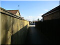
5
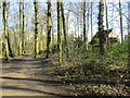
Path, The Warren, Bestwood Coiuntry Park
Close to the housing of St. Albans.
Image: © Jonathan Thacker
Taken: 31 Mar 2022
0.10 miles
6
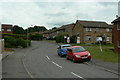
Lambeth Road
Part of the final stage of development of Top Valley. Originally planned as council housing, it was finally developed as private housing, under the name Warren Hill.
Image: © Alan Murray-Rust
Taken: 20 Jul 2010
0.10 miles
7
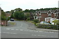
Grampian Drive
Off Bewcastle Road; it leads to a group of roads with names of British mountain ranges.
Image: © Alan Murray-Rust
Taken: 20 Jul 2010
0.15 miles
8
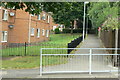
Footpath at Ruthwell Gardens
The fence on the right marks the boundary between the public and private sector sections of the final stage of the Top Valley development.
Image: © Alan Murray-Rust
Taken: 20 Jul 2010
0.17 miles
9
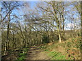
Path in The Warren, Bestwood Country Park
There is a steep drop to the left of the path.
Image: © Jonathan Thacker
Taken: 31 Mar 2022
0.18 miles
10
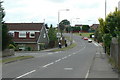
Muirfield Road
The eastern end, from Bewcastle road. One of the main distributor roads through the development.
Image: © Alan Murray-Rust
Taken: 20 Jul 2010
0.18 miles