1
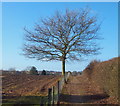
Track to New Farm
Image: © JThomas
Taken: 14 Mar 2010
0.06 miles
2
Farmland near New Farm
Image: © JThomas
Taken: 14 Mar 2010
0.07 miles
3
Redhill Lodge Drive postbox ref: NG5 474
Standard EIIR pillar box, distinctly out of vertical.
Image: © Alan Murray-Rust
Taken: 20 Jul 2010
0.13 miles
4
New Farm vicinity, Redhill NG5, Notts.
The public footpath that links Harberton Close, Redhill and the western edge of Bestwood Country Park is seen here at one of its highest points.
Image: © David Hallam-Jones
Taken: 16 Feb 2014
0.13 miles
5
New Farm vicinity, Redhill NG5, Notts.
Completed in 1863 for the 10th Duke of St. Albans, the latest Bestwood Lodge (now the hotel), is seen here protruding from trees in the distance. The public footpath that links Harberton Close, Redhill (15 minutes walk away, behind the photographer) and the western edge of Bestwood Country Park is seen here dropping down towards the approach road to New Farm.
Image: © David Hallam-Jones
Taken: 16 Feb 2014
0.13 miles
6
321 Mansfield Road, Redhill, Nottingham
Early 19th century house with rear wing housing traditional framework knitters workshop. Listed Grade II.
Image: © Alan Murray-Rust
Taken: 21 Aug 2019
0.13 miles
7
New Farm vicinity, NG5, Notts.
A section of the public footpath that links Harberton Close, Redhill and the western edge of Bestwood Country Park.
Image: © David Hallam-Jones
Taken: 16 Feb 2014
0.14 miles
8
Redhill, Mansfield Road
Image: © David Dixon
Taken: 13 Oct 2022
0.14 miles
9
New Farm vicinity, Redhill, NG5, Notts.
Harberton Close lies 10 minutes ahead on this public footpath linking the western edge of Bestwood Country Park (10 minutes away behind the photographer) and Redhill. The road in front of this pedestrian gate leads - on the left - to the drive of New Farm and towards Thornton Avenue, 10 minutes walk away in the other direction.
Image: © David Hallam-Jones
Taken: 16 Feb 2014
0.15 miles
10
Redhill, NG5, Notts.
This part of the Harberton Close-Bestwood Country Park public footpath shows it leaving the 'more enclosed' stretch that runs at the rear of houses on Richmond Gardens and Henry Street and coming out into farmland.
Image: © David Hallam-Jones
Taken: 16 Feb 2014
0.15 miles


