
IMAGES TAKEN NEAR TO
Gainsford Crescent, NOTTINGHAM, NG5 5FH
Introduction
This page details the photographs taken nearby to Gainsford Crescent, NG5 5FH by members of the Geograph project.
The Geograph project started in 2005 with the aim of publishing, organising and preserving representative images for every square kilometre of Great Britain, Ireland and the Isle of Man.

There are currently over 7.5m images from over14,400 individuals and you can help contribute to the project by visiting https://www.geograph.org.uk
Image Map
Images are licensed for reuse under creativecommons.org/licenses/by-sa/2.0
Notes
- Clicking on the map will re-center to the selected point.
- The higher the marker number, the further away the image location is from the centre of the postcode.
Image Listing (35 Images Found)
Images are licensed for reuse under creativecommons.org/licenses/by-sa/2.0
Image
Details
Distance
1
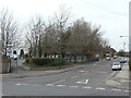
Gainsford Crescent junction
The western junction with Arnold Road. Andover Road (left) used to come straight out at this junction which has been substantially re-modelled to improve traffic flows.
Image: © Alan Murray-Rust
Taken: 15 Mar 2009
0.07 miles
2
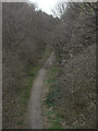
Railway trail
Footpath on the alignment of the old GNR Leen Valley branch railway seen from Arnold Road bridge.
Image: © Alan Murray-Rust
Taken: 15 Mar 2009
0.09 miles
3

Hucknall Road Walkway
On the trackbed of the former Great Northern Railway's Leen Valley branch. The walkway also provides an important wildlife corridor.
Image: © Alan Murray-Rust
Taken: 8 Feb 2022
0.10 miles

5

Cycle trail on former railway beside the A611
Image: © JThomas
Taken: 17 Apr 2010
0.11 miles
6
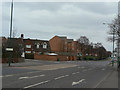
Arnold Road
Looking east from the former railway bridge.
Image: © Alan Murray-Rust
Taken: 15 Mar 2009
0.12 miles
7
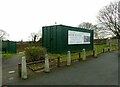
Room for hire
Not to be taken at face value – the room is in the neighbouring community centre.
Image: © Alan Murray-Rust
Taken: 8 Feb 2022
0.12 miles
8
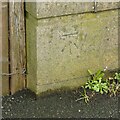
Bench mark, Arnold Road, former railway bridge
See https://www.geograph.org.uk/photo/7107244 for location.
Image: © Alan Murray-Rust
Taken: 8 Feb 2022
0.12 miles
9
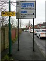
Arnold Road, former railway bridge
There is a benchmark https://www.geograph.org.uk/photo/7107243 on the parapet just to the left of the lighting column.
Image: © Alan Murray-Rust
Taken: 8 Feb 2022
0.12 miles
10

Hucknall Road Triangle
There was formerly a railway junction here, evidenced by the two visible bridges. The Nottingham to Derby line of the old GNR ran across the picture, under the bridge to the left (the arch is just visible in the brickwork), with a branch line curving from the right passing under the girder bridge and going on towards Mansfield. The area is being regenerated as natural heathland.
Image: © Alan Murray-Rust
Taken: 15 Mar 2009
0.12 miles