IMAGES TAKEN NEAR TO
Brownlow Drive, NOTTINGHAM, NG5 5BE
Introduction
This page details the photographs taken nearby to Brownlow Drive, NG5 5BE by members of the Geograph project.
The Geograph project started in 2005 with the aim of publishing, organising and preserving representative images for every square kilometre of Great Britain, Ireland and the Isle of Man.

There are currently over 7.5m images from over14,400 individuals and you can help contribute to the project by visiting https://www.geograph.org.uk
Image Map
Images are licensed for reuse under creativecommons.org/licenses/by-sa/2.0
Notes
- Clicking on the map will re-center to the selected point.
- The higher the marker number, the further away the image location is from the centre of the postcode.
Image Listing (20 Images Found)
Images are licensed for reuse under creativecommons.org/licenses/by-sa/2.0
Image
Details
Distance
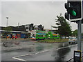
1
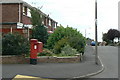
Haverhill Crescent postbox ref NG5 158
Standard EIIR pillar box with attached deliveries locker.
Image: © Alan Murray-Rust
Taken: 20 Jul 2010
0.03 miles
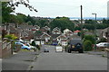
2
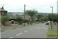
Brownlow Drive
Looking west near Roseneath Avenue.
Image: © Alan Murray-Rust
Taken: 20 Jul 2010
0.08 miles
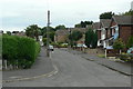
3
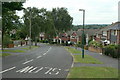
Brownlow Drive
This is the main distributor road in the northern section of Rise Park Estate. Looking west at Haverhill Crescent
Image: © Alan Murray-Rust
Taken: 20 Jul 2010
0.10 miles
4
Colinwood Avenue
Looking across to the southern part of Rise Park.
Image: © Alan Murray-Rust
Taken: 20 Jul 2010
0.15 miles
5
Roseneath Avenue
Looking south from Brownlow Drive.
Image: © Alan Murray-Rust
Taken: 20 Jul 2010
0.15 miles
6
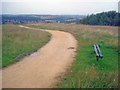
High-level path at Bestwood Country Park - 2
Looking westwards with the Hucknall by-pass in the valley ahead.
Image: © Trevor Rickard
Taken: 1 Aug 2009
0.18 miles
7
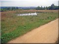
Small pond in Bestwood Country Park
Looking west from the hilltop to a small pond, part of the landscaping of the park to encourage wildlife. Above the pond in the distance is the large Rolls Royce plant at Hucknall.
Image: © Trevor Rickard
Taken: 1 Aug 2009
0.19 miles
8
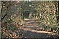
Route 6
NCN route 6 on the trackbed of the former Great Northern Leen Valley line
Image: © Richard Croft
Taken: 25 Nov 2011
0.21 miles
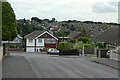
10
Crowthorne Close
Typical road in the Rise Park Estate.
Image: © Alan Murray-Rust
Taken: 20 Jul 2010
0.21 miles