
IMAGES TAKEN NEAR TO
Maitland Avenue, NOTTINGHAM, NG5 4GS
Introduction
This page details the photographs taken nearby to Maitland Avenue, NG5 4GS by members of the Geograph project.
The Geograph project started in 2005 with the aim of publishing, organising and preserving representative images for every square kilometre of Great Britain, Ireland and the Isle of Man.

There are currently over 7.5m images from over14,400 individuals and you can help contribute to the project by visiting https://www.geograph.org.uk
Image Map
Images are licensed for reuse under creativecommons.org/licenses/by-sa/2.0
Notes
- Clicking on the map will re-center to the selected point.
- The higher the marker number, the further away the image location is from the centre of the postcode.
Image Listing (8 Images Found)
Images are licensed for reuse under creativecommons.org/licenses/by-sa/2.0
Image
Details
Distance
1
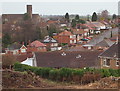
St Mark's Anglican Church, Woodthorpe, Notts.
A view of St Mark's Church from Breck Hill Road that may soon disappear if this land has been cleared prior to further building construction.
Image: © David Hallam-Jones
Taken: 1 Jan 2016
0.06 miles
2
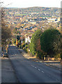
Breckhill Road
This climbs up from Woodthorpe to the Mapperley ridge, getting steeper as it gets higher.
Image: © Alan Murray-Rust
Taken: 18 Nov 2008
0.08 miles
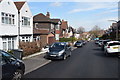
4
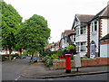
Woodthorpe: Whernside Road
A leafy 1930s suburb on a May evening.
Image: © John Sutton
Taken: 12 May 2014
0.20 miles
5
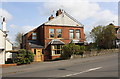
Nos. 65 and 67 Woodthorpe Drive
There is an Ordnance Survey benchmark Image on the side of the left hand house at the junction of the house and its porch extension
Image: © Luke Shaw
Taken: 1 Apr 2019
0.22 miles
6
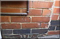
Benchmark on No. 65 Woodthorpe Drive
Ordnance Survey cut mark benchmark described on the Bench Mark Database at www.bench-marks.org.uk/bm44365
Image: © Luke Shaw
Taken: 1 Apr 2019
0.22 miles
7
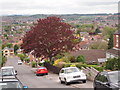
Nottingham - NG3 (Mapperley)
Beech Avenue meets Shortcross Avenue at its lower end and the suburb of Woodthorpe is stretched out beyond.
Image: © David Hallam-Jones
Taken: 11 May 2012
0.23 miles
8
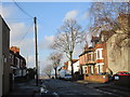
Gretton Road
The land drops steeply away at the end of the street.
Image: © Jonathan Thacker
Taken: 7 Dec 2015
0.23 miles