
IMAGES TAKEN NEAR TO
Dean Road, NOTTINGHAM, NG5 4FJ
Introduction
This page details the photographs taken nearby to Dean Road, NG5 4FJ by members of the Geograph project.
The Geograph project started in 2005 with the aim of publishing, organising and preserving representative images for every square kilometre of Great Britain, Ireland and the Isle of Man.

There are currently over 7.5m images from over14,400 individuals and you can help contribute to the project by visiting https://www.geograph.org.uk
Image Map
Images are licensed for reuse under creativecommons.org/licenses/by-sa/2.0
Notes
- Clicking on the map will re-center to the selected point.
- The higher the marker number, the further away the image location is from the centre of the postcode.
Image Listing (47 Images Found)
Images are licensed for reuse under creativecommons.org/licenses/by-sa/2.0
Image
Details
Distance

2
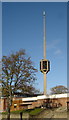
Catholic Church of the Good Shepherd, Nottingham
Image: © Oxymoron
Taken: 12 Nov 2008
0.07 miles
3
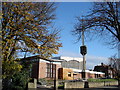
Catholic Church of the Good Shepherd, Nottingham
This ultra-modernist church makes an impressive statement; the detached spire-cum-bell tower [http://www.geograph.org.uk/photo/1042516] is especially striking.
Image: © Oxymoron
Taken: 12 Nov 2008
0.07 miles
4
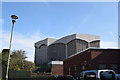
The Church of the Good Shepherd, Woodthorpe - rear view
A modern Catholic church, taken from the car park.
Image: © Trevor Harris
Taken: 20 Mar 2019
0.07 miles
5
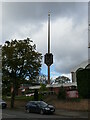
Spire, Church of the Good Shepherd, Arnold
Image: © Jonathan Thacker
Taken: 3 Nov 2023
0.08 miles
6
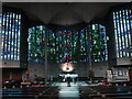
Interior, the Church of the Good Shepherd
An important milestone in the development of Catholic liturgy in the mid twentieth century. The church was designed by Gereard Goelen and the stained glass by Patrick Reyntiens https://historicengland.org.uk/listing/the-list/list-entry/1376603?section=official-list-entry
Image: © Jonathan Thacker
Taken: 3 Nov 2023
0.09 miles
7
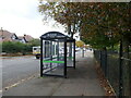
Bus shelter, Thackeray's Lane, Arnold
Image: © Jonathan Thacker
Taken: 3 Nov 2023
0.09 miles
8
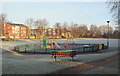
Thackeray's Lane, Arnold, Notts.
Thackeray's Lane Recreation Ground on a frosty morning. Thackeray's Lane, i.e. the A6211, lies outside the park's boundary railings behind the photographer. It seems likely the Thackeray mentioned here was Mr John L. Thackeray, an Alderman who resided in, and later rebuilt, a house called Arno Vale House. He owned cotton mills in the suburb of Radford and was the Mayor of Nottingham in both 1854 and 1856. He died in September 1886, aged 74 years.
Image: © David Hallam-Jones
Taken: 12 Jan 2014
0.10 miles
9
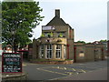
The Vale, Mansfield Road, Woodthorpe, Nottingham
Image: © JThomas
Taken: 1 Jul 2010
0.12 miles
10
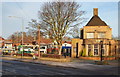
The Vale Hotel, Mansfield Road, Nottingham, NG5
The front of this historic pub faces Mansfield Road, i.e. the A60, whereas this south-easterly end faces Thackeray's Lane, i.e. the A6211. The bus appears to be heading towards Sherwood and then on to Nottingham city centre. These licensed premises were designed by the Nottingham born and nationally acclaimed architect Mr T. Cecil Howitt. It was designed as a hotel and built in 1935-37 with two single-storey wings and art deco style semi-circular bowed windows, one of which is seen here. A further single storey wing room was added to the rear in 1964 in similar style with a bay window by Howitt & Partners. The original internal layout has been retained with only a modest 'opening-up' and overall the pub is a Grade II-listed building because of its late-1930s 'Moderne' style. Also visible is its notable inn sign, the subject of a separate statutory listing, consisting of a circular base with carved bench seats and a fluted Doric column of stone with a capital topped with a three sided lantern that has been replaced by sign boards. Thackeray's forms part of the boundary separating Nottingham (NG5) and the town of Arnold in the Borough of Gedling.
Image: © David Hallam-Jones
Taken: 12 Jan 2014
0.12 miles