
IMAGES TAKEN NEAR TO
Elmswood Gardens, NOTTINGHAM, NG5 4AY
Introduction
This page details the photographs taken nearby to Elmswood Gardens, NG5 4AY by members of the Geograph project.
The Geograph project started in 2005 with the aim of publishing, organising and preserving representative images for every square kilometre of Great Britain, Ireland and the Isle of Man.

There are currently over 7.5m images from over14,400 individuals and you can help contribute to the project by visiting https://www.geograph.org.uk
Image Map
Images are licensed for reuse under creativecommons.org/licenses/by-sa/2.0
Notes
- Clicking on the map will re-center to the selected point.
- The higher the marker number, the further away the image location is from the centre of the postcode.
Image Listing (89 Images Found)
Images are licensed for reuse under creativecommons.org/licenses/by-sa/2.0
Image
Details
Distance
1
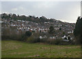
Sherwood Vale
Late 19th/early 20th century housing in Sherwood to the east of Mansfield Road.
Image: © Alan Murray-Rust
Taken: 8 Mar 2009
0.04 miles
2
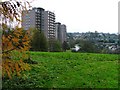
Blocks of Flats, Sherwood Station
Although the photograph was taken from SK5743 (just) it seems more appropriate to allocate this to SK5843 as that is the square the two blocks of flats, built on the site of the former Sherwood railway station, are in. The view is east towards Mapperlry Plains on the skyline.
Image: © Mick Garratt
Taken: 3 Dec 2005
0.10 miles
3
Harlequin Sky Over Woodthorpe Grange
This Park offers some sweeping views over the North of the city and beyond...
Image: © Tim Hallam
Taken: 14 Jun 2006
0.10 miles
4
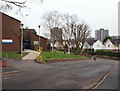
Nottingham, NG5 - Sherwood
With the initial section of Elmswood Gardens and Mansfield Road (A60) both behind the photographer, this is a view of the middle section of Elmswood Gardens with Sherwood Health Centre on the left and the two tower blocks - "Woodthorpe Court" and "Winchester Court" situated on Chestnut Walk, in the distance.
Image: © David Hallam-Jones
Taken: 24 Nov 2012
0.11 miles
5
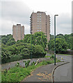
Sherwood: Woodthorpe Court and Winchester Court
The two tower blocks stand on the site of the short-lived Sherwood Station on the Nottingham Suburban Railway, open to passengers from 1889-1916 and to goods until 1951.
Image: © John Sutton
Taken: 17 Jun 2014
0.12 miles
6
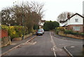
Nottingham, NG5 - Sherwood
The top bar of a T-shaped cul-de-sac known as "The Rise", off Elmswood Gardens. Just visible in front of the street light is an alley leading towards a secondary entrance into Woodthorpe Grange Park.
Image: © David Hallam-Jones
Taken: 24 Nov 2012
0.12 miles
7
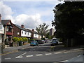
Cavendish Vale, Sherwood
Seen from Winchester Street, with Woodthorpe Court towering in the distance.
Image: © Richard Vince
Taken: 14 Jul 2012
0.12 miles
8
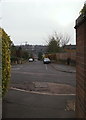
Nottingham, NG5 - Sherwood
An alley used by pedestrians to exit Woodthorpe Grange Park and out onto the top-bar section of a T-shaped cul-de-sac known as "The Rise", that is off Elmswood Gardens.
Image: © David Hallam-Jones
Taken: 24 Nov 2012
0.12 miles
9
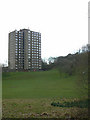
Woodthorpe Court
Twin to Image, they have been refurbished for elderly people.
Image: © Alan Murray-Rust
Taken: 8 Mar 2009
0.13 miles
10
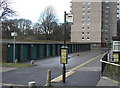
Is this really a bus stop?
The idea of having a bus stop in a set of lock-up garages might be thought rather bizarre, but there is a good reason.
When the two tower blocks - Winchester and Woodthorpe Courts - were refurbished for elderly persons, there was a campaign for a bus service right to the blocks due to the steep access road into the site off Sherwood Vale. The road layout to the blocks was designed without expectation of a bus service, and forms a cul-de-sac. The normal roads do not provide any space for a bus to turn round, so the only recourse was to loop the route through the garage yard. When first started, the road surface was nowhere near as well constructed as it is today.
Image: © Alan Murray-Rust
Taken: 8 Mar 2009
0.13 miles