1
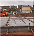
Haydn Road Area, Sherwood, NG5
6-8 new houses being are currently being built on a plot of land between Cameron Street and Victoria Street. The entrance to Haydn Road Infants School is immediately behind the photographer and Victoria Street is on the opposite side of this development.
Image: © David Hallam-Jones
Taken: 13 Jun 2013
0.01 miles
2
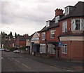
Eastern half of Crossman Street, Sherwood
The eastern half of Crossman Street, Sherwood, just after midday on Christmas Day 2012. One of the high rise blocks of flats in Woodthorpe is just visible in the distance.
Image: © Richard Vince
Taken: 25 Dec 2012
0.04 miles
3
Haydn Road Junior School
Image: © Mick Garratt
Taken: 3 Dec 2005
0.04 miles
4
Western half of Crossman Street, Sherwood
The western half of Crossman Street, Sherwood, just after midday on Christmas Day 2012.
Image: © Richard Vince
Taken: 25 Dec 2012
0.05 miles
5
Sherwood NG5, Nottingham.
Looking down Victoria Street from the junction with Owthorpe Grove. Victoria Street empties into Haydn Road directly ahead in approximately 200 metres (220 yds).
Image: © David Hallam-Jones
Taken: 13 Jun 2013
0.05 miles
6
Nottingham - NG5
Although these premises at the junction of Haydn Road, Sherwood with Cameron Street now host a small number of business and retail units it was originally a cinema.
Image: © David Hallam-Jones
Taken: 22 Apr 2012
0.05 miles
7
Benchmark on Owthorpe Grove wall of #53 Victoria Road
Ordnance Survey cut mark benchmark which was verified in 1962 is described on the Bench Mark Database at http://www.bench-marks.org.uk/bm35153.
Image: © Roger Templeman
Taken: 10 Aug 2010
0.06 miles
8
Houses on Victoria Road, Sherwood
A motley collection of houses on Victoria Road north from its junction with Owthorpe Grove (left foreground). Like several in this area, the house in the foreground appears once to have been a corner shop.
Image: © Richard Vince
Taken: 14 Jul 2012
0.06 miles
9
Benchmark on the side of Haydn Cafe
Ordnance Survey 1962 cut mark benchmark which is described on the Bench Mark Database at http://www.bench-marks.org.uk/bm35152
Image: © Roger Templeman
Taken: 10 Aug 2010
0.07 miles
10
Weathered benchmark on wall on south side of Haydn Road
Ordnance Survey cut mark benchmark described on the Bench Mark Database at www.bench-marks.org.uk/bm115862
Image: © Luke Shaw
Taken: 1 Feb 2020
0.08 miles


