
IMAGES TAKEN NEAR TO
Broxtowe Street, NOTTINGHAM, NG5 2JT
Introduction
This page details the photographs taken nearby to Broxtowe Street, NG5 2JT by members of the Geograph project.
The Geograph project started in 2005 with the aim of publishing, organising and preserving representative images for every square kilometre of Great Britain, Ireland and the Isle of Man.

There are currently over 7.5m images from over14,400 individuals and you can help contribute to the project by visiting https://www.geograph.org.uk
Image Map
Images are licensed for reuse under creativecommons.org/licenses/by-sa/2.0
Notes
- Clicking on the map will re-center to the selected point.
- The higher the marker number, the further away the image location is from the centre of the postcode.
Image Listing (118 Images Found)
Images are licensed for reuse under creativecommons.org/licenses/by-sa/2.0
Image
Details
Distance
1
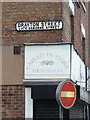
Drayton Street, late Osborne Street
The sign probably goes back to the 1920s or earlier, so there probably won't be many people now who remember it by its old name. Note also the cast iron Hydrant sign set high up on the wall.
Image: © Alan Murray-Rust
Taken: 15 Mar 2009
0.02 miles
2
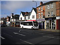
Anonymous bus on Mansfield Road, Sherwood
A demonstrator, on short term loan to Nottingham City Transport for evaluation, sitting in the northbound bus lay by on Mansfield Road at the junction with Broxtowe Street. This is at the southern end of Sherwood district centre, hence the diverse collection of shops (including a food outlet with an apparently very simple menu).
Image: © Richard Vince
Taken: 25 Aug 2011
0.03 miles
3
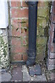
Benchmark on No. 511 Mansfield Road
Ordnance Survey cut mark benchmark described on the Bench Mark Database at www.bench-marks.org.uk/bm114811
Image: © Luke Shaw
Taken: 1 Apr 2019
0.03 miles
4
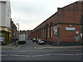
Melrose Street
Looking down the side of the former Sherwood Tram Depot
Image: © Alan Murray-Rust
Taken: 15 Mar 2009
0.03 miles
5
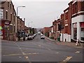
Nottingham - Sherwood NG5
A view of Haydn Rd, Sherwood from its junction with Mansfield Rd (A60) looking in the direction of Hucknall Rd (A611). This road forms part of a "rat run" for traffic between Mapperley, Sherwood and the B682 (Nottingham Road) and onto Basford.
Image: © David Hallam-Jones
Taken: 16 Mar 2012
0.04 miles
6
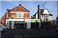
Nos. 509, 511 & 513 Mansfield Road
There is an Ordnance Survey benchmark Image on the right hand side of the middle shop (New Leaf Sensory Massage) beside a black downpipe.
Image: © Luke Shaw
Taken: 1 Apr 2019
0.04 miles
7
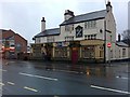
The Sherwood
Or, according to the sign on the main body of the building, The Sherwood Inn.
On Mansfield Road, Sherwood, Nottingham.
Image: © David Lally
Taken: 30 Dec 2009
0.04 miles
9
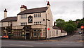
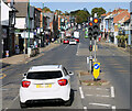
Sherwood, NG5, Nottingham.
The Sherwood Inn at the junction of Lloyd Street with Mansfield Road (the A60).
Image: © David Hallam-Jones
Taken: 13 Jun 2013
0.04 miles
10
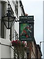
The sign of The Robin Hood
From across the road: Image
Image: © David Lally
Taken: 5 Aug 2017
0.04 miles